Bridgwater to Highbridge along the River Parrett

It has been quite some time since I last did a station to station walk, for reasons that don’t need stating. While I remain wary, I am gradually re-acquiring my fondness for public transport – though I really wish that mask wearing remained compulsory. The day began with a walk of a couple of miles to the nearest place buses to Bristol call on a Sunday (another time, I’ll be happy to have a long discussion on the poor quality of public transport when the journey is between two council areas, despite the existence of West of England Combined Authority as regional transport authority… but not today). I’ve not done much walking recently, first because it was too hot, then because it was too wet. Today I had decided to keep smiling whatever the weather. Still, it was annoying to get soaked by an unexpected shower on this first leg, before I had even really started!

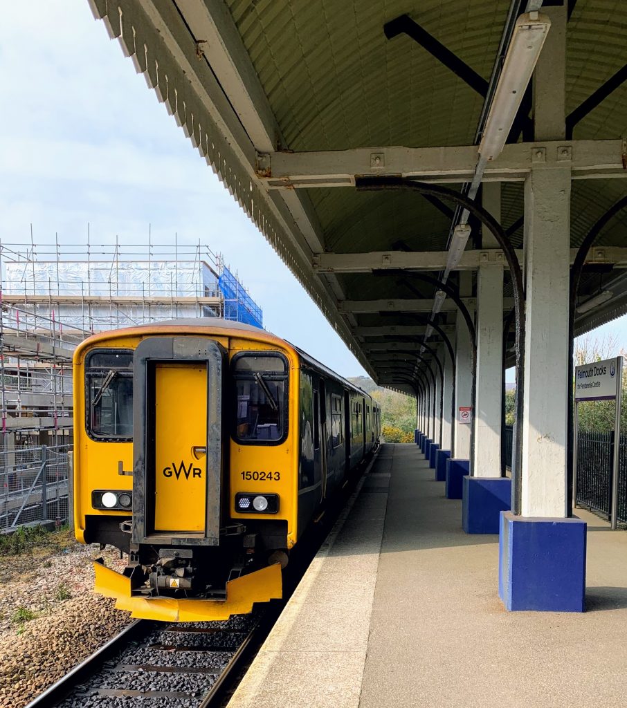
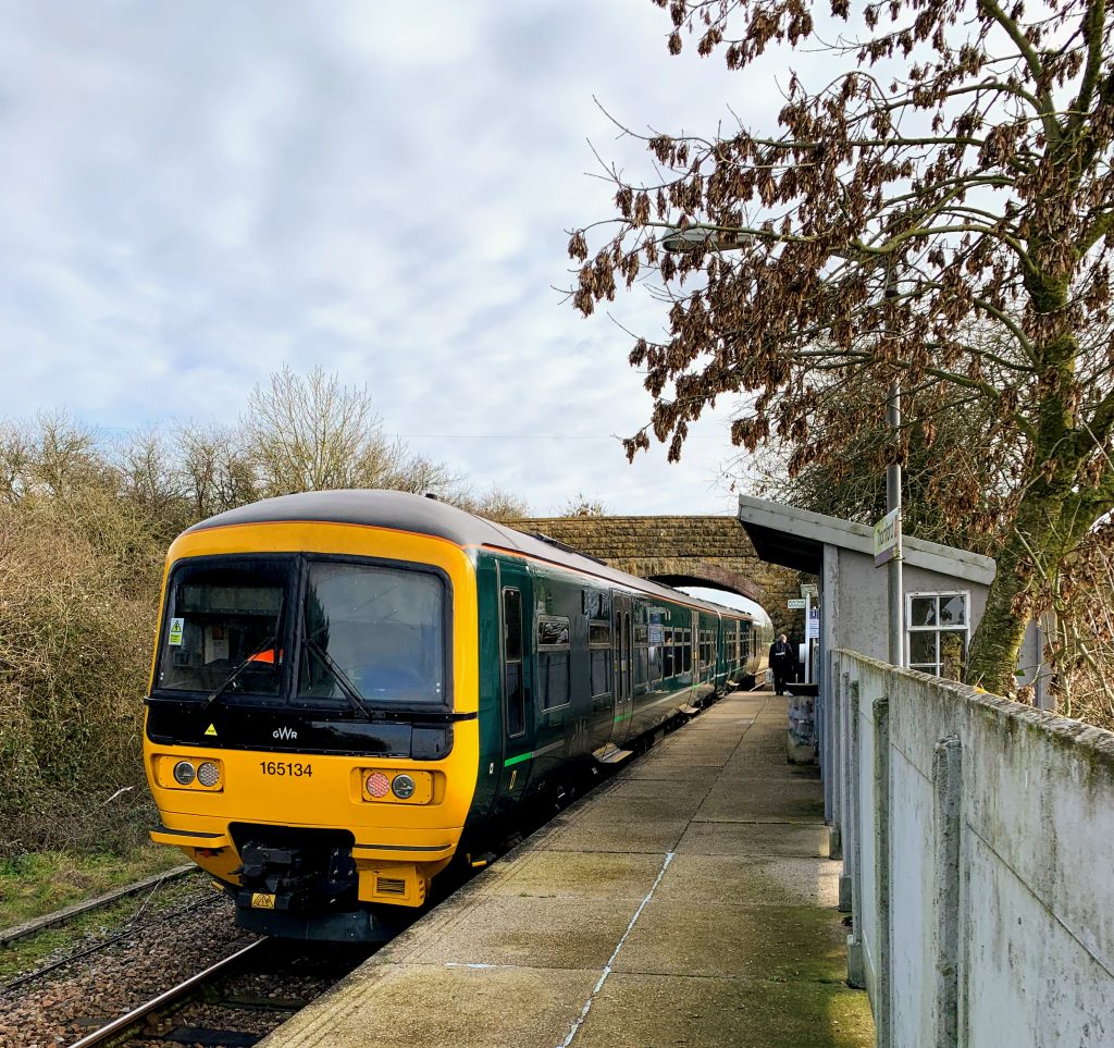
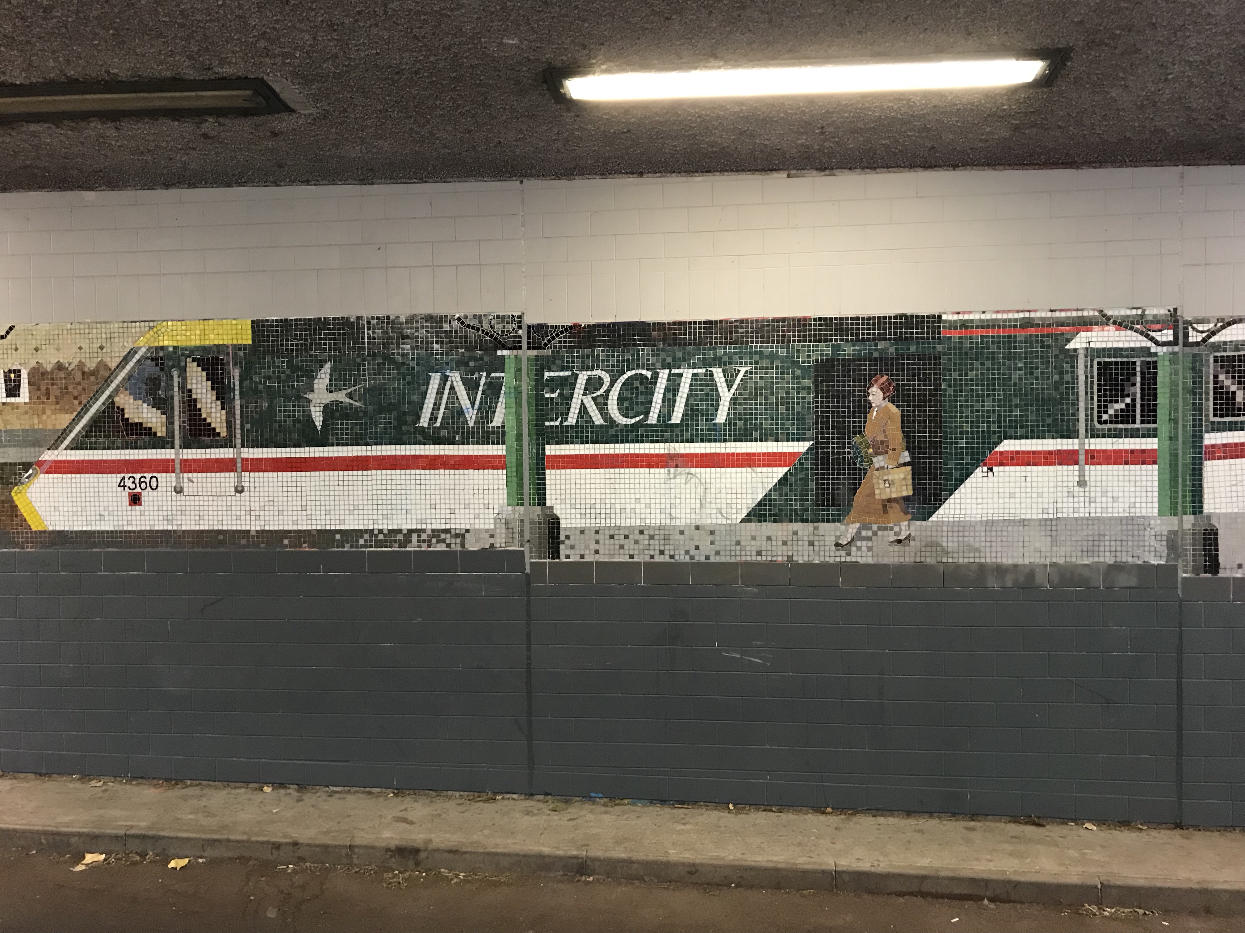
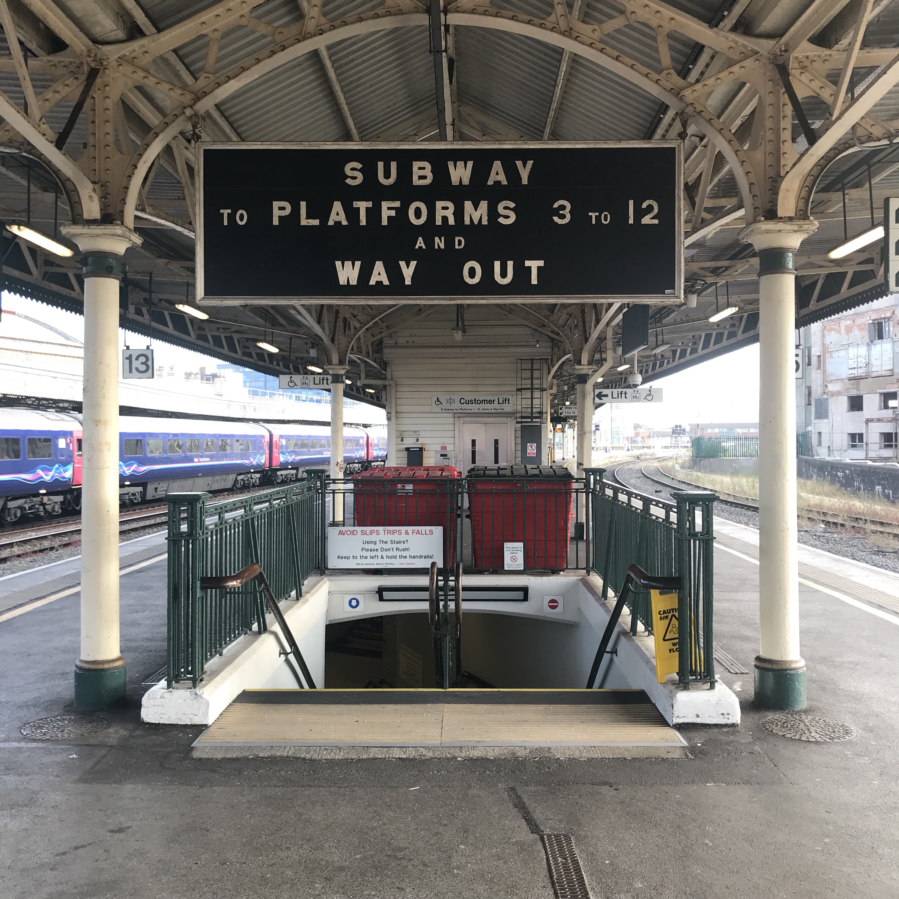
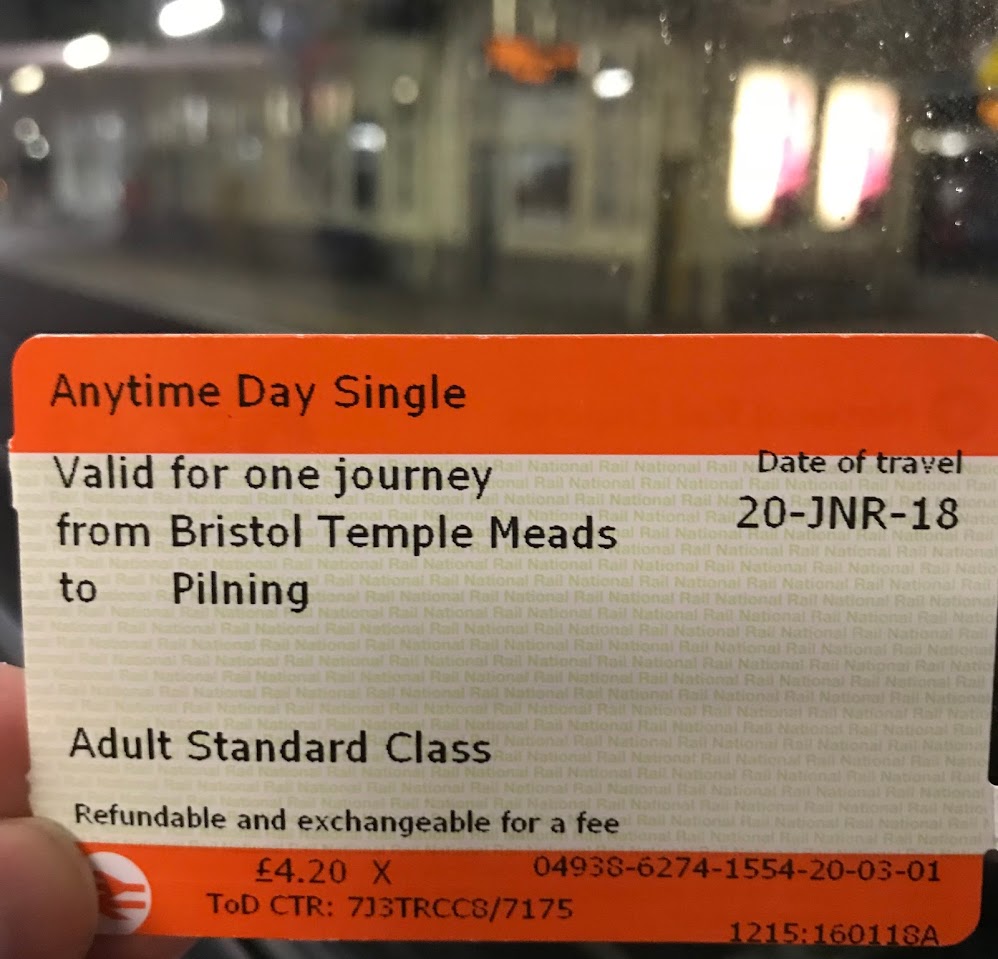
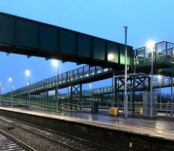
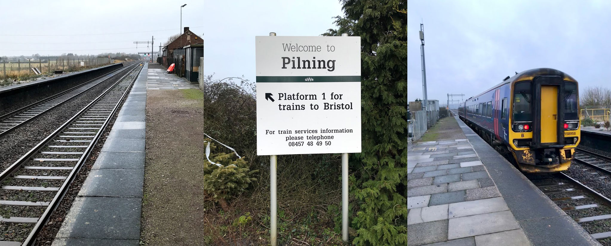
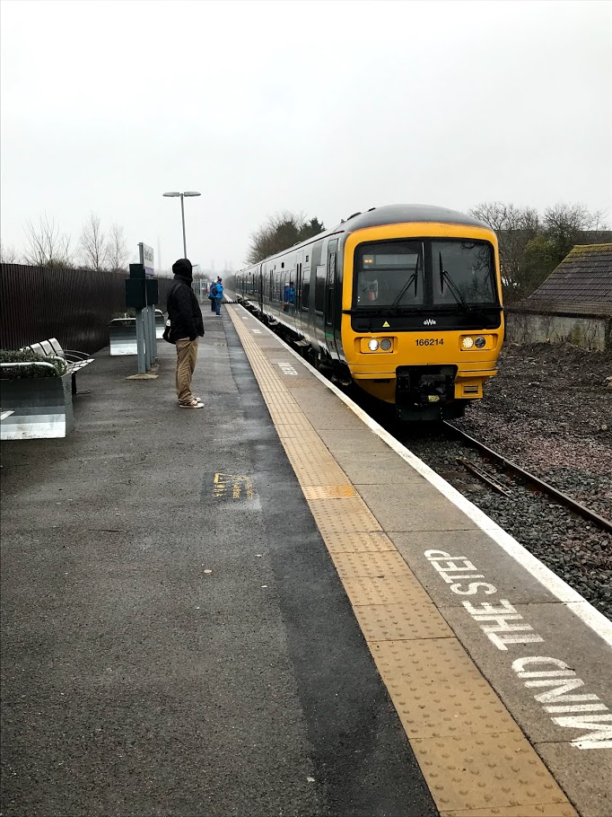
After a damp bus journey, I caught the train to Bridgwater from an eerily quiet Bristol Temple Meads. Network rail are currently making significant improvements to the track layout at Bristol East Junction, as well as to the station buildings (including restoring the roof and making a new station entrance). Excitingly this includes making provision for additional suburban services in the future. While all this is going on, the service from Temple Meads is limited.

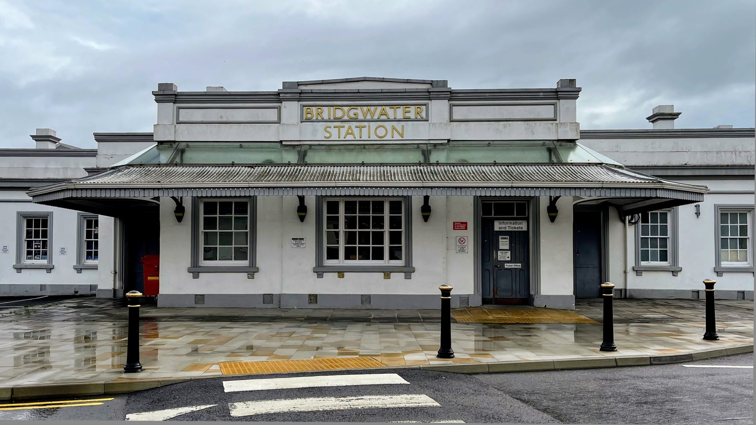
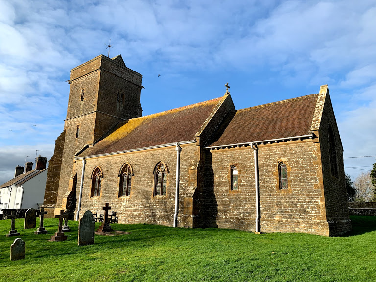
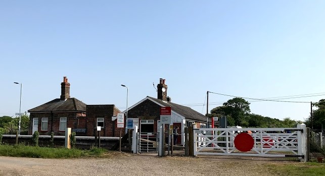
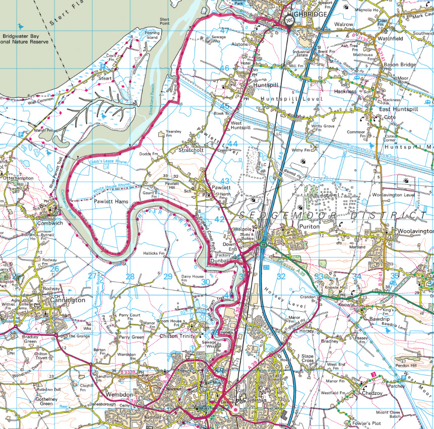
Bridgwater Station is rather magnificent, retaining the original buildings (not shown in their best light by my underwhelming photo). The start of the walk proper was complicated by being unsure how to get to the path – fortunately I spotted the unsigned narrow alley between two industrial buildings and emerged onto the banks of the River Parrett.

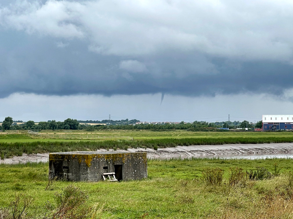
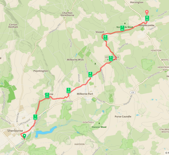
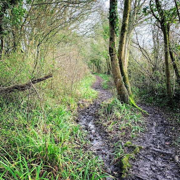
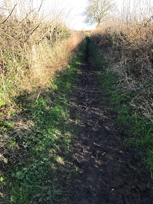
The weather continued to play its part. This first part of the walk was overgrown and my feet were quickly soaked. My shoes are waterproof, but there is only so much they can do! The situation improved markedly when the path became part of the England Coast Path. From that point on the walk is mostly on a gravelled, and very obvious, track. There was still a threat of a proper soaking though, and the funnel cloud and dark skies were a constant reminder.

The World War II pillboxes along the route were part of the Taunton Stop Line, intended to delay any invading forces long enough to allow reinforcements to arrive. There are (at least) five along this stretch of the river, and more at the Highbridge end. These are a reminder that there are much worse things than rain and poor bus services (though arguably decent, sustainable public transport will be one element in fighting climate change, which is likely to be the most important issue of all before too long.)

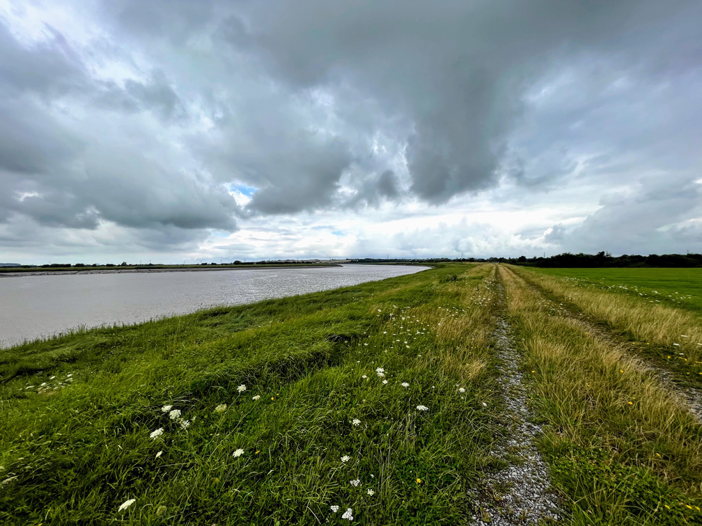
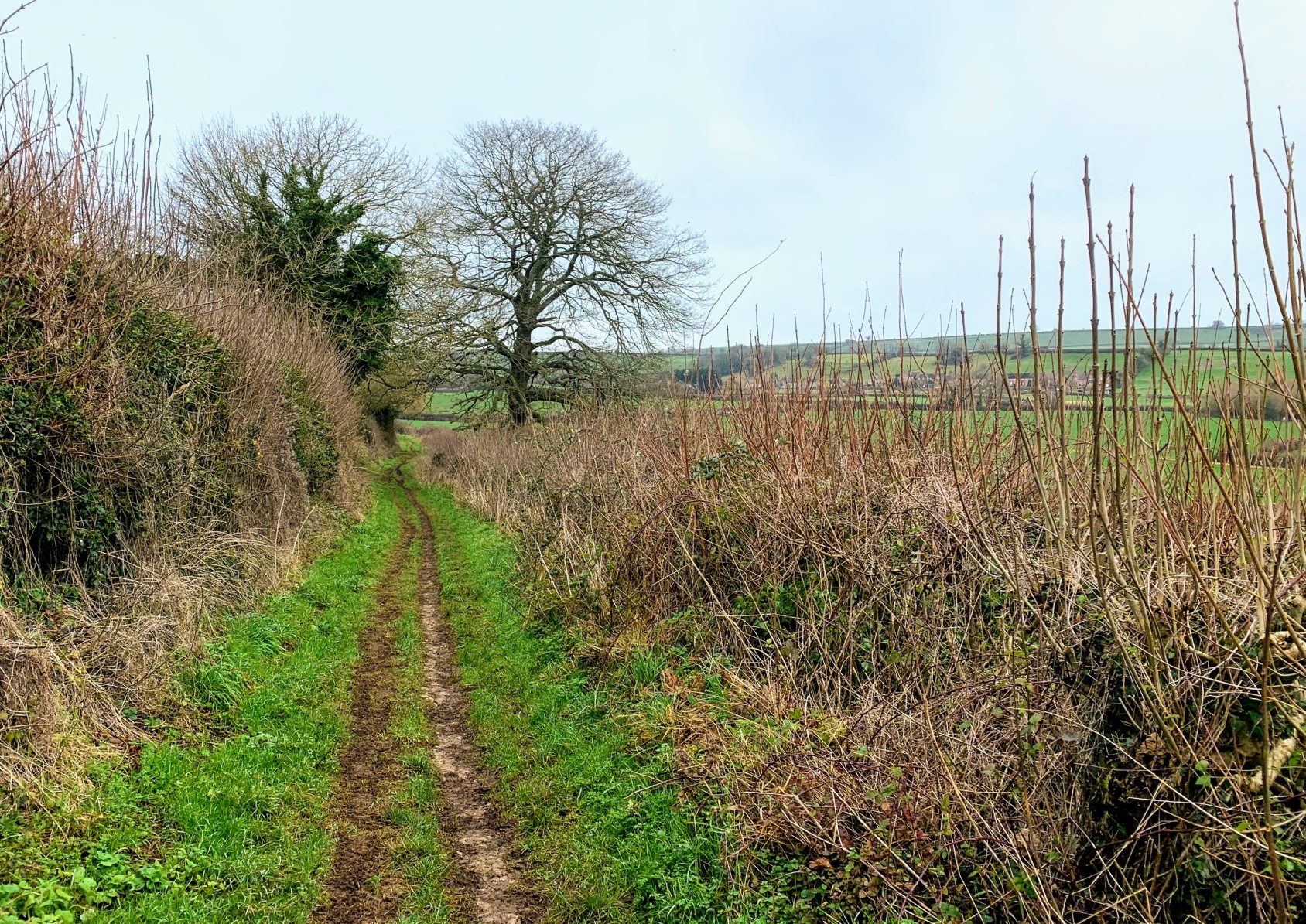
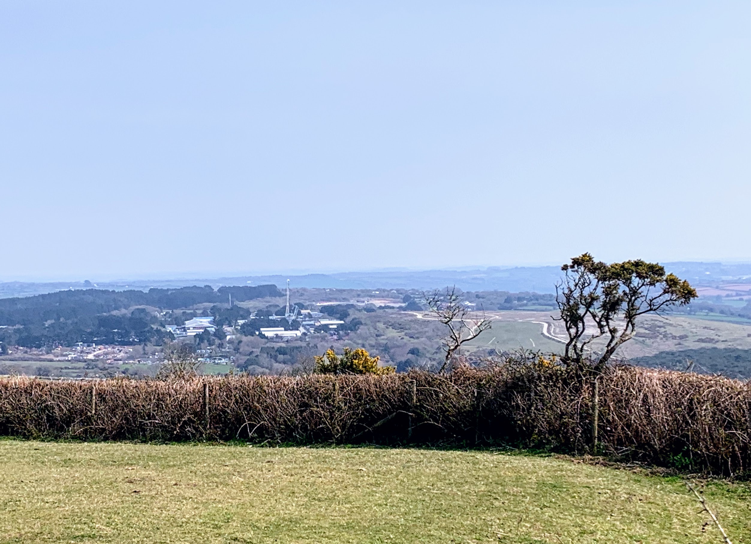
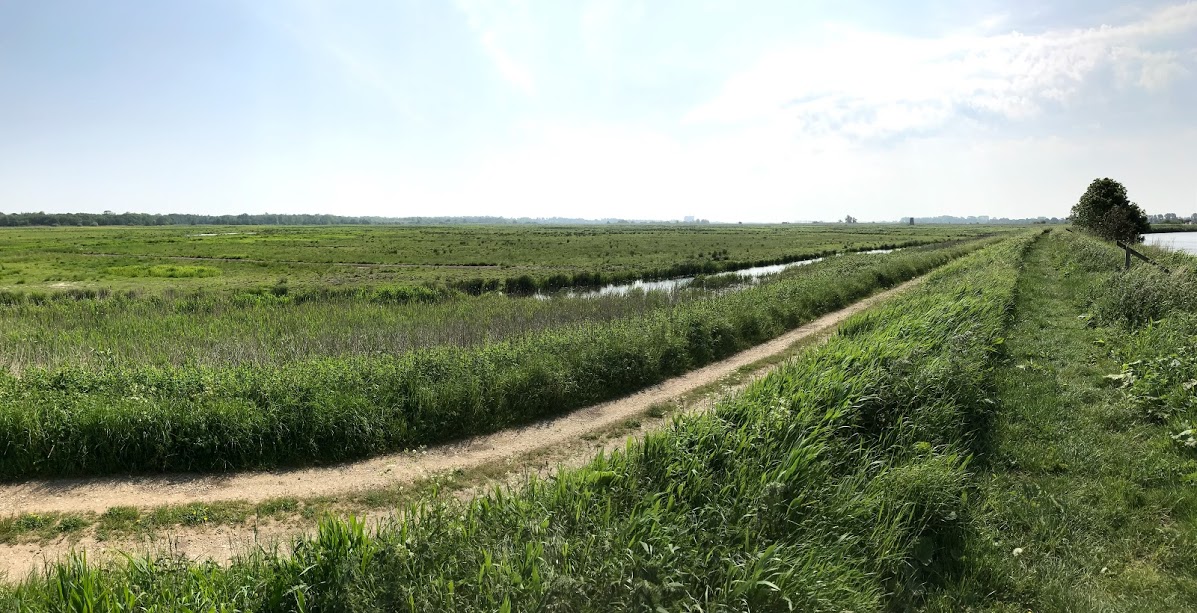
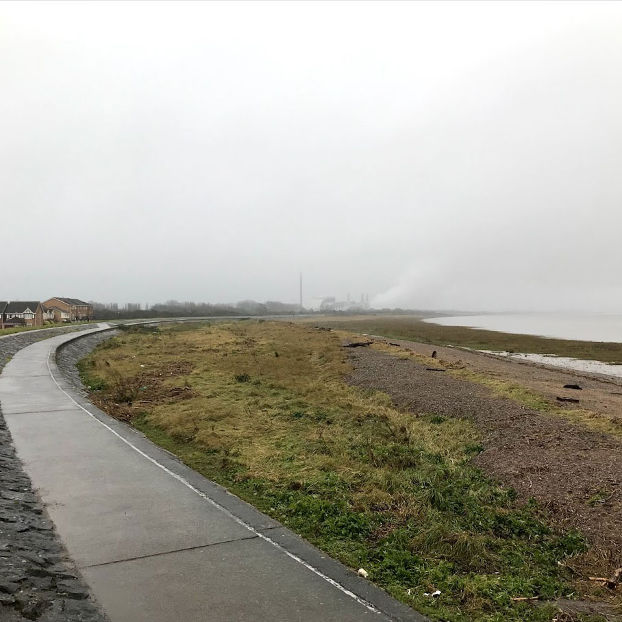
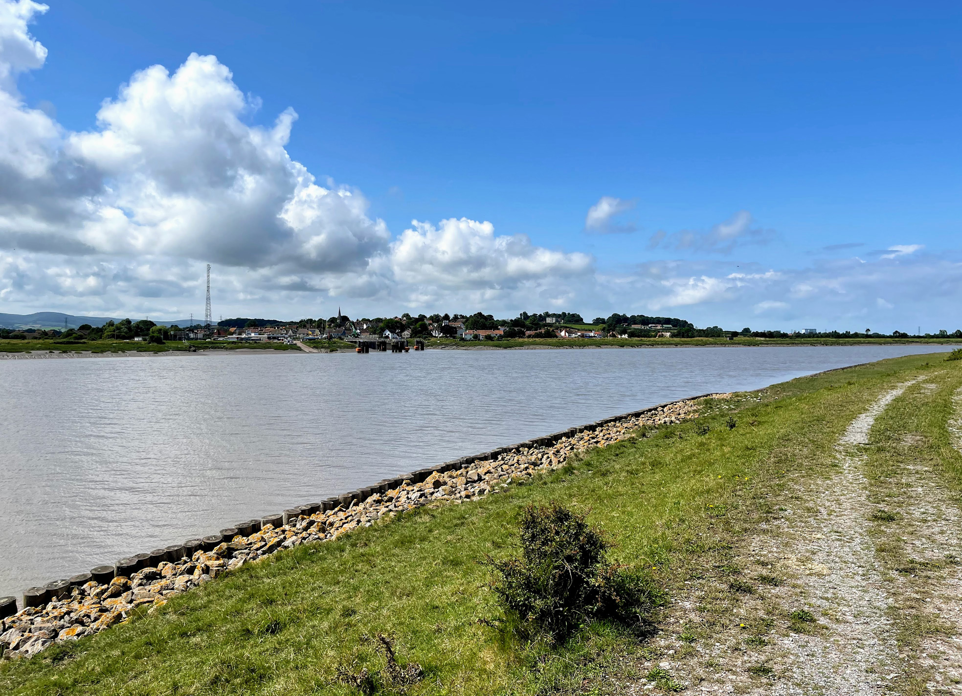
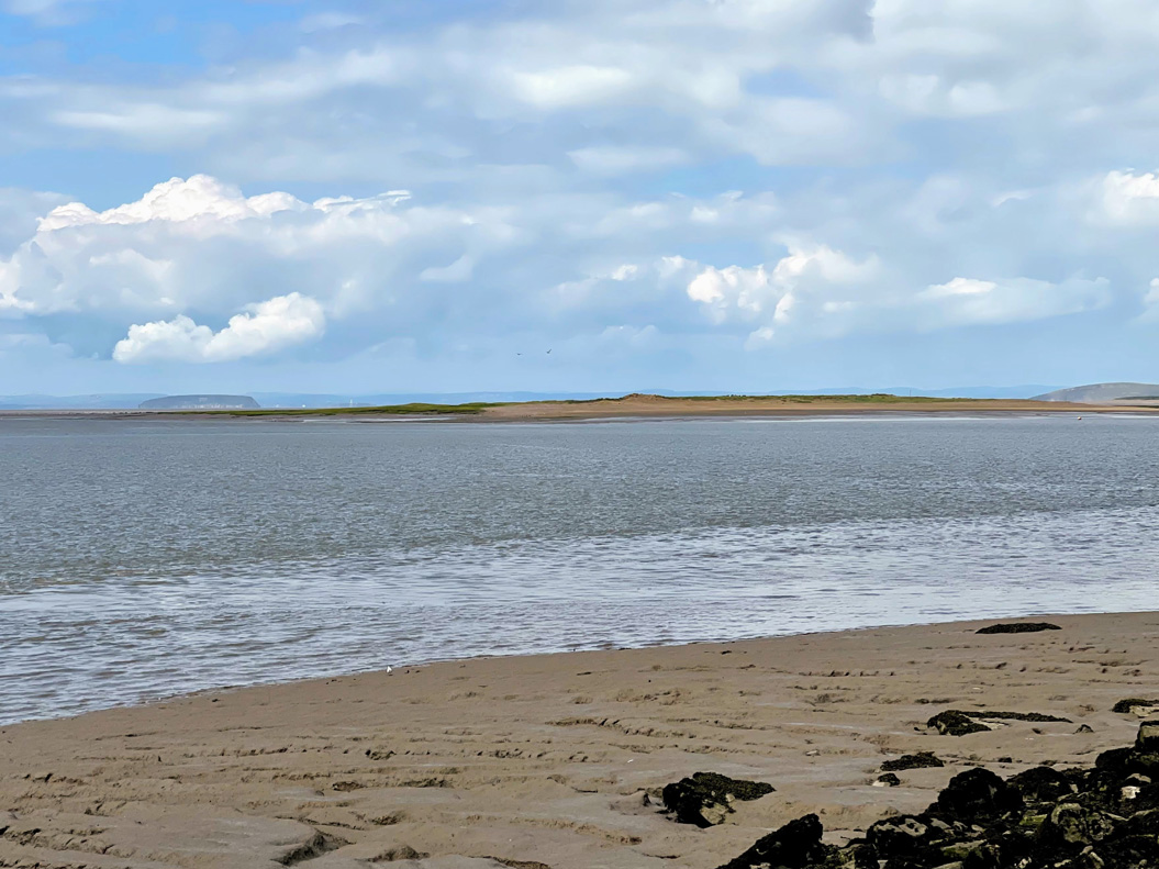
For the most part, the rest of the walk was easy and pleasant. The weather gradually improved, and the flat ground underfoot soon dried out. The walk is essentially a succession of views like those above. Big skies, and wide vistas across the slowly broadening river.

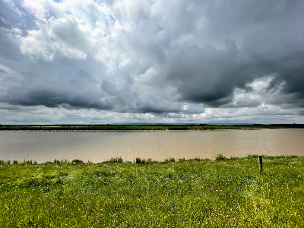
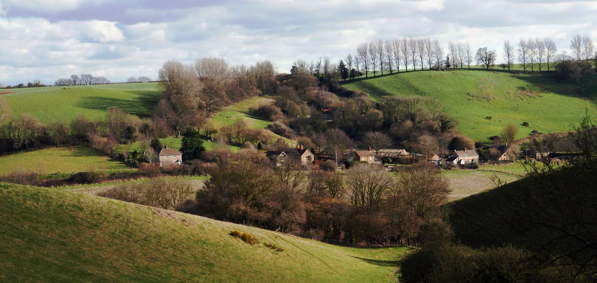
The outlook is very attractive, with the Quantocks to the left and the Mendips to the right.

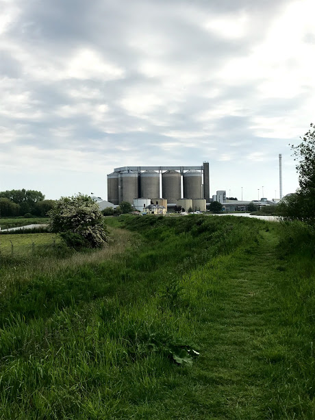
I stopped for lunch on the opposite bank to Combwich, which presumably owes its existence to the port. These days it is mostly used to serve the construction of nearby Hinckley Point C nuclear power station – the biggest building site in Europe.

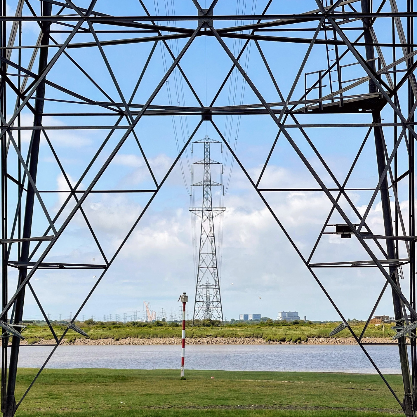
Hinckley Point is ever present, visible for miles around and the pylons are impossible to ignore. Fortunately, I like pylons. Moreover on this walk they served as a useful compass in a landscape in which it can be difficult to maintain a sense of direction. I didn’t get a selfie in my “Atomenergie? Nein Danke” T-Shirt, which is a shame!

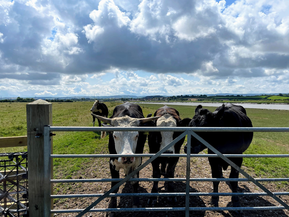
Earlier I noted that walk was pleasant “for the most part.” These fine looking fellows were the cause of the unpleasant part. Well, not exactly these guys but their over-protective harem. They resolutely stood exactly where I needed to get to. As I warily approached I was charged by around 30 cows. This was very scary. Cows are big, and they can move surprisingly fast. I am fairly experienced with cows, and don’t usually have a problem. Normally, unless they are with their calves, they either ignore or are quietly curious. I knew not to run, but had nowhere to go. All I could do was walk steadily close to the river, speak loudly and hope they realised I was not a threat. Most did, but a few came very close and gave me no room for manoeuvre. I couldn’t, of course, walk on the muddy bank and in a wetter season I couldn’t have been where I was either. The gate was the only way through a barbed wire fence, but fortunately I noticed a small section that looked climbable, and hopped over (probably more of a clumsy leap).

Unfortunately this incident means I cannot wholeheartedly recommend this walk. In parts the path is fenced off and this really needs to be done along the whole way. I was many miles from anywhere, if I had been hurt nobody would have been there to help. If I had been walking from Highbridge I would have been entirely stuck. I know it is legal to have bulls with cows in a field with a footpath, and it is often no problem, but on a national trail (like the England Coast Path) I think you should be assured of a safe passage.

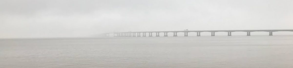
Once I calmed down, I carried on, now worried about whether there would be any further encounters. There weren’t. The last few miles opposite the incredibly flat Stert Peninsula with Burnham-on-Sea coming into view, were fantastic. The England Coast Path winds around Steart Point so at some point I will be able to look back on this walk from a different perspective. Maybe I’ll shake my fist at the distant cows.

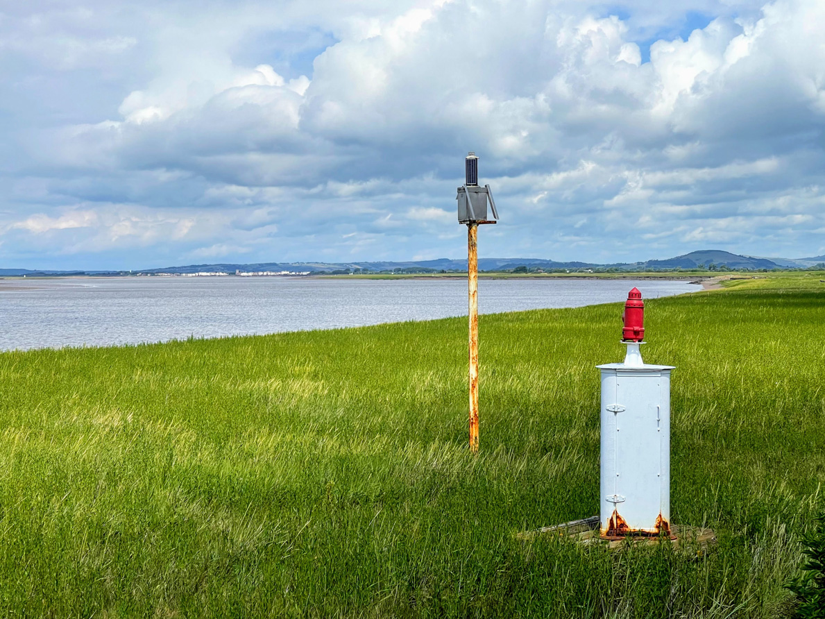
I had noticed several beacons marked on the OS map and was curious to see what they were like on the ground. Kinda cute!

Another one of my (many) obsessions is islands, so I was keen to get a good look at Stert Island as I approached Burnham-on-Sea. It is not particularly impressive, but an island is an island. Gotta spot ’em all… According to wikipedia, it was formed in about 1798 when it broke off the Stert Peninsula. It is (as is so often the way) important for birds. You can see the (somewhat more impressive) Steep Holm in the background.

As an aside, Steart or Stert? Both it seems. According to A History of the County of Somerset: Volume 6, Andersfield, Cannington, and North Petherton Hundreds (Bridgwater and Neighbouring Parishes) “The name of the village and moors is pronounced locally with two syllables, that of the point and island with one.” The spelling seems to reflect that, though I am not sure I have it right everywhere in this post.

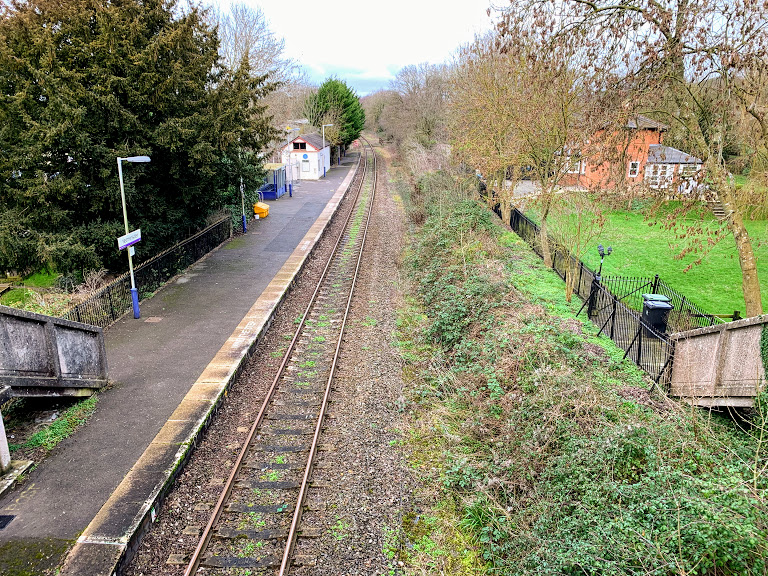
Finally, somewhat wearily, I arrived at Highbridge. I had about half an hour until the next train, so I popped in to the Coopers Arms next to the station. The fact I had a pint of Kronenbourg 1664 tells you about the selection of beer, but it was a decent looking pub nonetheless. It went down very nicely. The station itself is functional. It does have the unusual feature of being built on a bridge over the River Brue. I’m not sure how many other stations have a river.

Overall, apart from the cow incident, this was a really great walk. Easygoing, simple to navigate, relaxing and peaceful. Apart from the cows.

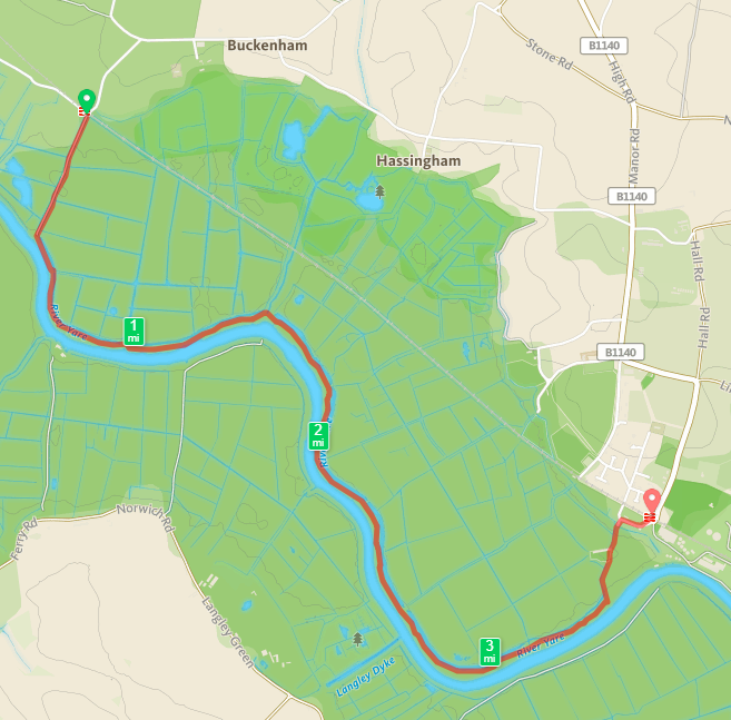
Distance: 14.5 miles.

Station to Station: Sherborne to Templecombe

I’ve signed up for the #walk1000miles challenge this year. Last year I set myself a target of 500 “boots on” miles, and smashed it by walking 825 miles. I am also hoping that a side effect will be that I keep this blog a little more up to date too.

Today I walked a route I’ve been meaning to do for a while. I work near to Templecombe station, so travelling the 8 minutes to Sherborne and walking the 8 miles back was always on the cards. I am acutely aware of how muddy the entire countryside is at the moment, so planned a route via lanes and tracks, avoiding crossing open fields as much as possible. Nevertheless, I still found myself boot deep in stinking mud fairly often on this walk.

I left Sherborne station via the level crossing and set out through the town. Although I’ve been to the station a fair few times, I’ve never walked through the town before. It’s a really attractive place and deserves more of my attention in the future. It has a reputation as retirement central, and didn’t disappoint on that front to be honest.

Fairly soon I left Sherborne along Underdown lane towards Oborne. I had to walk through a shoot, which was slightly un-nerving, though I guess they must have spotted me since hardly anybody (or any dogs) moved a muscle while I strolled along the lane. Oborne itself is a pretty little village, but there isn’t much else to say about it. Google certainly thinks it’s most notable feature is the hotel.

I left Oborne via the bridleway that leads to Crackmore Farm. This started out as a pretty steep climb, a feature of the landscape around here, as I was about to find out. Just after the farm is Vartenham Hill, which I obviously knew would be steep from the dense contour lines on the map, but was *really* steep. The footpath is straight up too, not much in the way of zig-zagging. The view from the top was great, although the weather was not particularly conducive to prolonged sight-seeing (or indeed to seeing long distances).

I skipped around the edge of Milbourne Port and joined Old Bowden Way, heading towards Henstridge Bowden. This turned out to be another very steep climb up an extremely muddy path. Not the most fun part of the walk.

Henstridge Bowden hardly exists really, just a few out-of-my-price-range properties. From there I headed through the grounds of Bowden House towards Stowell. The track here was more like a river than a lane. A good test for the waterproofness of my boots (they passed). I considered heading into Stowell itself to have a look at the church, but I decided to save that for another day. It was a straightforward (muddy) walk back to Templecombe following the railway line. All in all, a throughly enjoyable afternoons walking.

Distance: 8.16 miles

Station to Station: Redruth to Perranwell

I’ve had this one planned for quite a while, and a weekend away in Falmouth provided the opportuntity to get boots on the ground. It was also another occasion when I was walking with company – one of my oldest friends David. The weather looked good, but we hadn’t bargained for the strength of the wind! The start of this walk was quite exposed. If you follow in our footsteps, wrap up warmer than we did!

We caught the train from Falmouth Docks, changing at Truro and heading south west to Redruth. The Penzance train was about 40 minutes late at Truro, but we were in no rush so for us this was just a minor irritation. We grabbed a coffee in the heated waiting room.

Once at Redruth, we headed out of the town via Sea View Terrace. It seemed unlikely that the the sea really could be viewed. However, as we climbed up the hill we were proved wrong. Although the weather today was not going allow us to actually see the sea, the radome covering the air defence radar at RRH Portreath was clearly visible.

Our first planned destination was Gwennap Pit. This is a grass covered amphitheatre where John Wesley preached eighteen times between 1762 and 1789. The present form came about after his death, when locals remodelled it as a memorial. Originally, it seems to have been a hollow caused by subsidence from mining activities, and presumably appeared less regular than it did now. It was larger originally too. Wesley himself claimed to have preached to 22,000 people there. Pevsner is sceptical of this, saying he “either mis-remembered or exaggerated”, but I am not so sure. Certainly there is no way that that many people could fit in the pit itself, but as this report from The Graphic on 17 June 1876 points out, there is room for large numbers in the surrounding area and large crowds still gathered even then:

But whatever Gwennap Pit was, it is now an insignificant hollow in a hill side; “looks nothing in itself, sir when it’s empty you might easily pass by and not notice it,” said a man of whom we asked our road. And he was right so that any one who expects to find the chasm, like the crater of a huge volcano, in which the engraving, so popular in West Cornwall, represents Wesley, perched on a jutting rock, preaching to assembled thousands, will be sadly disappointed. So far from being a grand chasm, “the Pit” makes no break in the unmitigated ugliness of the Redruth neighbourhood. The print, like many other prints of the kind, is untrue in every point, except in the matter of the assembled thousands. These may be seen every Whit-Monday– a great day everywhere among the Cornish Methodists. Crowded trains run at single fare, hundreds tramp in afoot, every sort of conveyance brings its quota, and, by the afternoon, when the services’ begin, there are sometimes 20,000 people gathered in and about the Pit.”

The Graphic – 17 June 1876

From Gwennap Pit, we descended into Carharrack. The view from the path above Carharrack is terrific, if (like me) you enjoy a slightly industrial landscape. The pub in Carharrack was not open, and indeed has slightly restrictive (and unusual!) opening hours scrawled on the blackboard outside – “Monday – Closed all day, Tuesday – closed, Wednesday Thursday – Closed all day, Friday Saturday Sunday, 7pm to 12:00.” I guess they know they their local market! According to the sign outside, this was “Cap’n Blood’s Tavern”. He must have been away during the week.

We then walked through Outer Wood, accompanied by increasingly severe warnings not to stray off the path. Danger of Death was enough to keep us firmly out of the trees. The dangers arise from the old mine workings of Wheal Squire, part of United Mines, which produced 20,000 tons of copper from 1816-1853. Some of my ancestors were copper miners at the time in this general area, so it is fascinating to imagine what the world was like for them. I suppose there were fewer health and safety warnings…

From here, the route was across the fields to Frogpool. I went to Frogpool just once as a child, and for some reason all I can remember is that it seemed very white! It still does – the buildings seem almost universally to be painted white. We were pleased to arrive at the (white) pub before it closed, with minutes to spare, and stopped for a pint. The clientele and bar staff seemed very friendly, and the beer was good.

From here it is a short walk along roads and byways into Perranwell. The path we choose took us via Bargus and under the railway line. It also meant that we had no choice but to go past the pub, and since it was open it would clearly have been rude not to. This was another fine pub, with good beer and an exceptionally tasty looking menu. One for another day.

From the pub to the station is only a few minutes, but we misread the timetable and the last few hundred metres were more of a rush then expected. In the end though our timing was perfect and we were soon back in Falmouth planning some more beers for the evening.

Distance: 8.2 miles


Station to Station: Freshford to Avoncliff

That rarest of rare things – an afternoon without the kids. A beautiful crisp sunny February afternoon at that. So what could be better than a short stroll along the canal? A short stroll along the canal that also takes in two stations – that’s what!

This was intended to be a longer walk, but we started a bit later than planned. Oh yes, we. On this occasion I was walking with my wife – something we don’t get the opportunity to do on our own very often. Walking with the kids is fun too, but this was a proper treat.

We parked up at Avoncliff Station – kinda. We tucked in on a verge alongside the narrow road some distance from the station in fact. Avoncliff is a tiny station, that well deserves its original title of Avoncliff Halt. Judging from how full the car park is it is a popular place for starting a walk . We caught the train to Freshford, a 3 minute journey.

Freshford is an altogether different affair, the long sweeping platforms seem vast after the diminutive Avoncliff. But it is still pretty. There is a garden that for years was maintained by the Vaisey sisters, daughters of the village doctor. When it was restored by local villagers in 2007, Network Rail reportedly swept in and chopped it all down! It was looking pleasant when we were there, so I suppose it has now been re-restored. You can read about the incident here: https://www.independent.co.uk/voices/columnists/miles-kington/miles-kington-the-railway-station-garden-that-set-a-rival-village-apart-464377.html

We then walked through the fields, crossing under the railway line at Limpley Stoke. This was the decision point. The original plan was to walk up the hill and through the woods to Monkton Combe before heading down to Dundas Aqueduct. But time was already ticking on, so instead we crossed the Avon via the road bridge and joined the Kennet & Avon Canal.

The walk back along the canal was perfectly peaceful – apart from the occasional interruption from the trains. It was, as all walks along canals are, easy going. Other than that, there isn’t actually much to say about it. We walked past a sign describing the history of Murhill Wharf and Tramway, where stone was transported from the nearby quarry. There are apparently some GWR remnants to be seen, but we missed them this time.

Before long we were back at Avoncliff, walking over the impressive aqueduct. If you look carefully, you can see that the central section has a pronounced sag. This happened shortly after the aqueduct was completed in 1801, and it has had to be repaired many times since.

All walks that end at a pub are worth doing, and this one was no exception. It says something about the peculiarity of the weather at the moment, that we sat outside with our drinks. In February. In our coats, of course, but even so. A perfect end to a pleasant walk.

Station to Station: Thornford to Yetminster

A quick jaunt after work on a pleasant winters day, taking in two small Dorset request stop stations, a pub and (a new obsession) a place called Beer.

I started by catching the train at Castle Cary to Thornford. I knew I had to ask the guard to let me off at Thornford, but I struggled to get any of the train staffs attention. It turned out this was because they were discussing a man who had left the train at Castle Cary – after urinating out of the train doors. Alcohol can be a bad thing!

I was not the only request stopper at Thornford, which was not a complete surprise. According to the usage figures there are roughly 10 entries and/or exits a day (3,448 a year). It would be a very nice place to live and commute from, and I suspect that was the reason for my fellow traveller’s departure.

The station is about a mile from the village itself, but there is a dedicated footpath and it is a very simple walk. I only saw a small section of the village, so any judgement I make about it would be unfair. I’ll still do it though. There were lots of Range Rovers and even a Maserati. I doubt there is much affordable housing. But it was very pretty, and the pub (The Kings Arms) was very good. I had a tasty pint of Dorset Rogue by Piddle Brewery.

My next port of call was Beer Hackett. The route there was via two connected lanes – Horsepool Lane and Claypits Lane. I love walking along tree lined lanes like this. It is easy to imagine people tramping along them for generations, essentially unchanged now from then. Even though many modern roads follow traditional routes, they have lost that feeling. On this particular day, however, it was very soggy underfoot and the benefits of modern metalled roads were obvious.

The lanes eventually lead me back to the road, just outside the village of Beer Hackett. Me being me, I immediately started wondering how many places there are called “Beer” and can I visit them all? I don’t know the answers to these questions – but expect occasional pictures of signs as I add to my collection!

I didn’t hang around long in Beer Hackett, but I did visit the churchyard. The sun had come out, and the church looked splendid. I had to hurry on to catch the train, so I didn’t explore inside. Something for another day.

The footpath from Beer Hackett to Yetminster crosses the railway line. I am always childishly excited at these crossings. On this occasion, I could be fairly certain there would not be any trains – the next one due would be the one I was on. Nevertheless, I sense a certain very low level danger when actually stepping over the rails, which is crazy!

I arrived at Yetminster with no time left to explore the intriguing looking antiques shop and cafe near the station, let alone time to venture into the village or find the pub. I am planning a walk from Chetnole to Yetminster, so hopefully I may have more opportunity next time. I did get to hear the distinctive chime of the church clock. Every three hours, it plays the national anthem!

Yetminster station itself is small and lacking in facilities, but was clearly larger in the past. I don’t know when the second platform closed, nor the enormous derelict Railway Inn right beside the platform. I rather like the concrete stairways down to the platform from the road. Yetminster is another request stop, twice as well used as Thornford. Yet again, I was not alone in signalling clearly to the driver.

All in all, a very pleasant walk, although I wish I had not dawdled so much at the beginning to give me more time in Yetminster.

Station to Station: Lawrence Hill to Bristol Temple Meads

A quick post this morning while waiting for a train in Bristol. I arrived at Temple Meads way earlier than I needed to so decided I might as well visit a station I’ve not been to before. The nearest one is Lawrence Hill, so I bought a ticket and hopped on the early train to Cardiff.

The trip to Lawrence Hill is only a few minutes. The train was fairly busy – presumably mostly with commuters. A few got on at Lawrence Hill, but I think I was the only one to get off. There isn’t much to say about the station itself. It sits in a cutting nestled below the A420. Two platforms, basic facilities. Exactly what’s needed in a location like this.

The walk back is about a mile, and is mostly along the Bristol and Bath cycle path. It was busy with bikes so wits need to be kept! Honestly, the walk is not hugely picturesque or anything like that, although the Railway Passage murals are worth a look.

So now I’m back at Temple Meads – still with over an hour before my train!

Station to Station: Buckenham to Cantley

I took the opportunity of a family holiday visiting friends in Norwich to get in a stroll along the River Yare between two stations on the Wherry Line – Buckenham and Cantley.

Buckenham is one of the country’s least used stations – the tenth least used in 2016/17 – with only 122 Entries and Exits. This is partly at least due to its remoteness. There is literally nothing else around. But this is also its appeal. Being right by RSPB Strumpshaw Fen must surely make it a useful stop for birdwatchers? Not being one myself, perhaps there are other better places nearby.

The low usage numbers are not helped by the paucity of services of course – 1 each way on a Saturday, 5 each way on a Sunday and none at all in the week. It is also a request stop. Given all this, I was slightly surprised to find 2 other people got off at the same time as me. One of whom had a swish camera and took pictures of the station sign. There is at least one person as pointlessly obsessed with doing this as me!

I didn’t have long to hang around at Buckenham since I needed to be sure of catching the train at Cantley. The route is pretty straightforward following an obvious path along the banks of the Yare. It is also stunningly beautiful on a sunny Sunday morning.

I was intrigued by The Beauchamp Arms on the other side of the river. These days there is no easy way to get across, although it seems there used to be a ferry. Now that could make this into an even more appealing walk!

Other than the stunning scenery, the profusion of Azure Damselflies and the pleasantness of the weather there isn’t much more to say about the walk through the Cantley Marshes. It is easygoing  although the heat of this particularly morning sapped my energy faster than I was anticipating.

The sugar factory is an impressive human intervention on the landscape. I always enjoy the counterpoint. For a sense of scale, the Reedcutter pub can be seen just beneath the tanks.

Cantley station is another wonderful small station, although significantly better used than Buckenham, with a correspondingly higher level of service. It also has a traditional manually controlled gate level crossing. The signalman physically leaves the signal box and closes the gates across the road. This is wonderful and feels like a direct connection to a bygone age. I don’t know how much longer this will be here – I presume there must be plans to upgrade the signalling along this line  and the level crossing would probably be a casualty of that – so catch it while you can!

The journey back to Norwich was less pleasant than the journey out – a single carriage train which was full to bursting. Passengers were even turned away at Brundall station. Still, this did not detract from a wonderful morning walk through the Norfolk countryside.

Station to Station 2: Castle Cary to Bruton

My second Station to Station walk was between Castle Cary and Bruton – a walk that took me about 2 hours on foot and about 7 minutes back on the train!

I really don’t know very much about the town of Castle Cary, despite driving past it every day on my commute. I didn’t learn much about it today since the station is outside the town and my route took me around the outskirts through the adjoining village of Ansford.

From this point on the walk follows the Leland trail, named after John Leland, librarian to King Henry VIII. This trail is a reconstruction of part of the route he took when visiting South Somerset between 1535 and 1543 cataloging the contents of monastic libraries and antiquities. Sounds like a great job to me.

I deliberately chose this route to walk along a track that I’ve noticed almost every day and  wondered where it went – Solomon’s Lane. I do this a lot with footpaths. It transpires that until the road slightly further south was turnpiked in 1793, this was the main route to Bruton [1]. It doesn’t look much today. I wonder who Solomon was?

At the end of Solomon’s Lane, the path continues across some lovely Somerset countryside. Some slightly grumpy cows didn’t really want to move, so I walked off route a bit to give them some more room. The path continues through an orchard before arriving back at the road near to the village of Cole.

After passing under the current railway line, the road eventually passes under another bridge that once carried the Somerset and Dorset Joint Railway on its route from Evercreech to Cole. There isn’t that much left to see of it in this area, but it does seem to haunt all my walks. By the way, this bridge is labelled SAD-116, and another one that the road passes over SAD-115. I’m not sure whether these labels are original or not, but I can feel a box ticking exercise coming on.

The last part of the walk is across the wide open fields of Wyke Farm, and finally down a well trodden lane into Bruton itself. Bruton is a very pretty town, full of history and tradition. It’s also, well, I can’t quite find the word – posh isn’t quite it, nor does hipster quite cover it. The fact that the Spar sells craft beer and Quinoa crisps maybe sums it up. I like it, by the way.

Frustratingly, I hadn’t left myself enough time to visit either of the pubs along the High Street, nor to pop into the museum. I fully intend to do this walk again, but using a more direct (hence quicker) route so that I can explore the town itself a bit more. This time I just headed straight for the station.

Bruton station is pretty quiet. (40660 entries and exits in 2016-17: 111 people a day). It was originally built as part of the Wilts, Somerset and Weymouth Railway, opening in 1856. These days it has a sporadic service through the day  – not regular. Hence the importance of catching my particular train, otherwise I had a 2 hour wait.

And so finally back to Castle Cary station, which sits astride the Taunton to Reading Line and the Bristol to Weymouth Line. It has a large (and quite cheap) car park to attract commuters, which is often quite full. However, the station really comes in to its own for the Glastonbury festival, when for a long weekend it is absolutely heaving – and well worth avoiding if you are not a festival goer.

Post walk note – I left my camera on a stile in the middle of this walk. I had to drive to a point as close to it as I could get and walk through the muddiest field I have ever seen in the vain hope that it might still be there. It wasn’t. However, a very kind woman had just picked it up for safe keeping and saw me striding with purpose and guessed it might be mine. And so I was reunited! I am incredibly grateful for kind strangers.

[1] ‘Ansford’, in A History of the County of Somerset: Volume 10, ed. Mary Siraut (Woodbridge, 2010), pp. 85-100. British History Online http://www.british-history.ac.uk/vch/som/vol10/pp85-100 [accessed 4 February 2018].

Station to Station 1: Pilning to Severn Beach

This is the first in a series of walks between two different stations.

As walked route from Pilning Station to Severn Beach station.

On the 20th January I finally walked a route that I’ve been looking at on the map for ages, with the added bonus of ticking off an ambition to get to Pilning station. Pilning is not the easiest of stations to get to – it isn’t even listed in the timetable anymore. Instead there is a note against two Saturday trains from Cardiff to Taunton saying “Also calls Pilning”. The timetable also advises that to get there from Bristol requires a change at Severn Tunnel Junction. This reflects the removal of the footbridge and the resulting closure of the westbound platform. There are now no direct services from Bristol Temple Meads.

I caught the 07:23 GWR service from Bristol Temple Meads towards Cardiff Central. The guard commented that in 10 years in his job, he had never checked a ticket for Pilning before! However, he knew the route and told me where to change. Impressive.

Severn Tunnel Junction is a strange station – seeming to consist mostly of enormous (presumably accessible) footbridges. I guess in theory it serves the village of Rogiet, and other local commuter traffic. Perhaps it is busier later in the day or in the week but it was extremely quiet when I was there (253,918 entries and exits in 2016-17, so yes I guess it gets a bit busier). I will be back to explore another time – not least to make the walk to nearby Caldicot station.

Next up, the 08:26 to take me back through the Severn Tunnel to Pilning. This time the guard was confused by my ticket (because it was from Bristol) and didn’t understand what I was doing. She let it pass because it was “hardly any distance”. I had the timetable on hand to explain if I’d needed to.

On arrival at Pilning I was handed a Station Guide leaflet by one of the passengers getting on, who presumably has some part in the running of www.pilningstation.uk (we didn’t really have time to talk!) This contains a really interesting history of the station itself and the railways in the surrounding area. Definitely has me piqued my interest enough to come back and explore.

Pilning itself shows its neglect. It is run down, has no facilities and at present is surrounded by a building site – working on the electrification of the line I guess. While this is a shame, I can understand the lack of investment. It is not a well-used station (230 entries and exits in 16/17 – though this is a large increase from the 46 the year before), and it is in an awkward place – not really that close even to the village it serves. Nevertheless, I suppose it would get more use if there were more than 2 trains a week! The history of the station is interesting – see http://www.pilningstation.uk/tell-me-more/the-past for more details. I may write some of my own thoughts in a future post.

So at last the walk! This is a pretty straightforward route, starting off along the road towards Pilning village. I took the footpath through the allotments and cemetery of St. Peter’s Church. At this point I think you can still make out where the old train line from Pilning Low Level to New Passage Pier passed through, taking passengers to the ferry across the Severn.

I didn’t have a lot of time to stop and explore, but still I was as stubborn as ever about actually following the footpath, even when this probably isn’t strictly necessary. The footpath that cuts the corner across the fields as the B4064 curves around to the SW is a case in point – it was not easy to find, was obstructed and covered with brambles and when I did get to it, was across a very muddy field. Having done it once, in the future I will probably just follow the road around. However, the next section alongside the M49 is well worth walking along – the path is good and it feels odd walking right next to the motorway.  The footbridge over the motorway was a revelation too – it wobbled!

And so to Severn Beach. The “seaside” town that time forgot. A very unusual place indeed. Today I did not have time to seek out the disused amusements, or really to take in any of the atmosphere – the weather was rapidly worsening and I was just glad to get to the station and catch the train back to Temple Meads. The header photo for this blog gives an idea of the conditions.

The Severn Beach line is wonderful. It starts with the bleak industrial landscapes of Avonmouth and the Severn Estuary, then runs down the beautiful Avon Gorge and finishes up through the heart of Bristol itself. I am already planning many excursions along the line.


This was a terrific morning out – some interesting train journeys and an easy walk. The only thing missing was a pub or two. It was too early in the morning on this occasion, but I will be doing the walk in the opposite direction in the future, and there are two pubs to visit in Pilning – one of which is conveniently near the station. Perfect.

Link to route on OS Maps