I’ve not written about my walks for ages, but just at the moment I am quite focussed on building some good habits in every area of my life – and writing this blog is one of them. Hence this short post, just to kick it off again.
Next weekend (22nd September) is the Circuit of Bath walk – a sponsored event in support of Julian House. I’ve walked it a few times before. It is a challenging 20 miles around the hilly fringes of Bath. I’m walking it with a friend of mine, so we decided we ought to do at least one practice walk. Hence this 10 mile wander up on to the Mendip plateau from Wells and back again.
It’s a great walk, including a fairly stiff climb at the beginning. We’ll have a few of those to overcome next weekend! Once at the top the views over the Somerset Levels are fantastic and well worth the effort. We even had a few hot air balloons to look down on.
After a bit of an aimless wander, mostly to make sure we put in the miles, we descended back down towards Wells via Ebbor Gorge. The view from the edge is spectacular. The descent after that is via some steep and large steps, and is pretty tough on the knees as I’m getting older.
Roll on next weekend – though if the forecast thundery rain could stay away, I’d be most grateful.
This walk is something I have wanted to do for a long time, and at last both my ability and an opportunity have come together. For me there is something special about walking home, from anywhere. I always planned to walk home from work, when my workplace was just about close enough for that to be possible. Indeed, I had vivid dreams about doing so. I never managed it, and now I work far too far away. So I am pleased to realise this particular ambition.
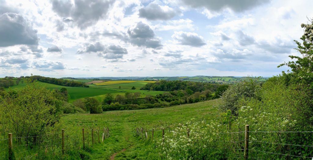
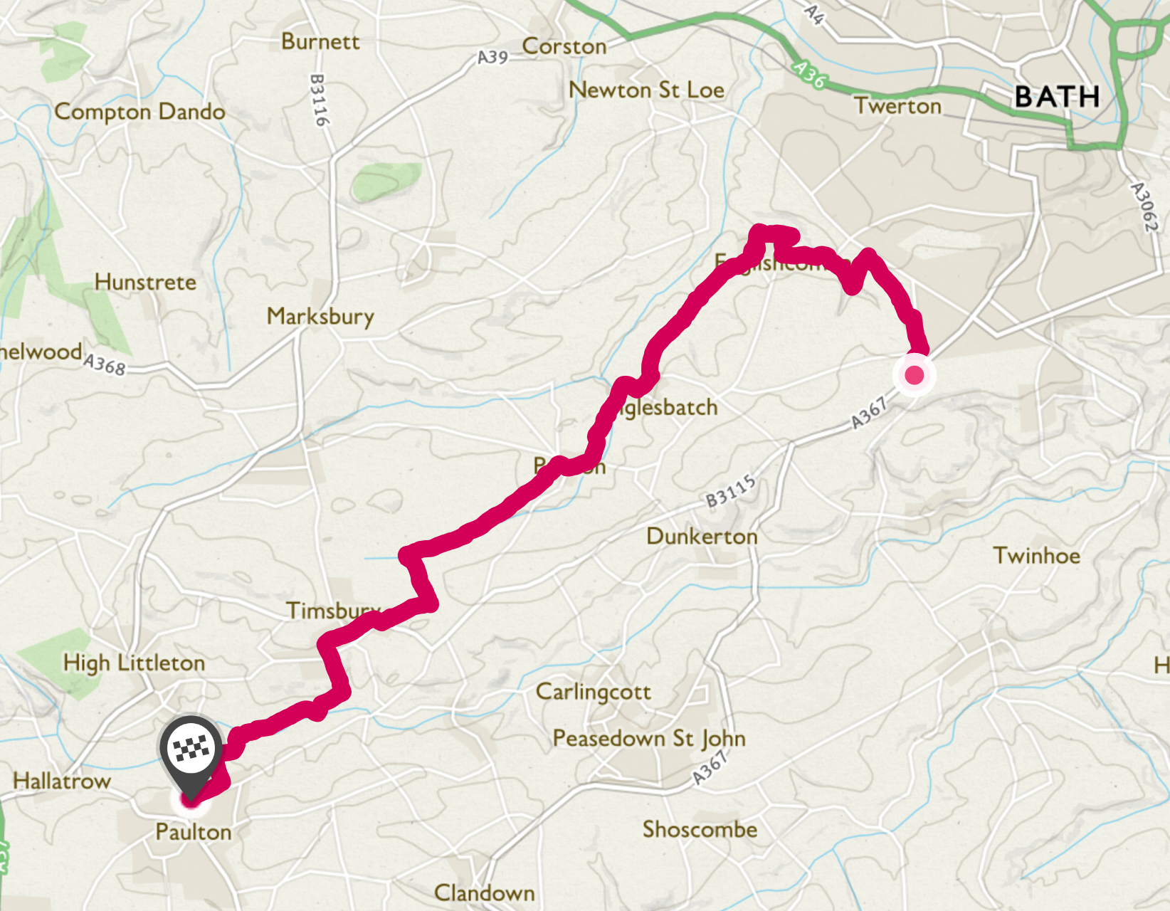
I walked from the outskirts of Bath. This cut out the climb from the city centre and leaves another challenge for another day! The route I chose is a fairly obvious one from a browse of the OS maps – via Englishcombe, Inglesbatch, Priston and Timsbury. The start of my walk, along the edge of Odd Down towards Rush Hill, afforded a beautiful view looking West across the hills and valleys that I would soon be walking through.
The first port of call was Englishcombe, an historic and interesting place. I was looking forward in particular to seeing what remained of Culverhay Castle. The honest answer is not much. The earthworks are clearly visible, but overgrown and it is hard to make anything out, at least when seen from the paths I was walking along. I will be passing this way again, so I’ll check it out from some different angles.
The castle has an interesting history. Built in stages between the 11th and 13th century, it was part of the Gournay estate. It met it’s demise after Thomas de Gournay was indicted for his part in the murder of Edward II and all his estates were confiscated by the crown. This included the other villages in this area called “Gurney”, including for example Farrington Gurney and Barrow Gurney. The castle was razed to the ground and the stones used by Bath Abbey to build the nearby Tithe Barn, a subject for another walk.
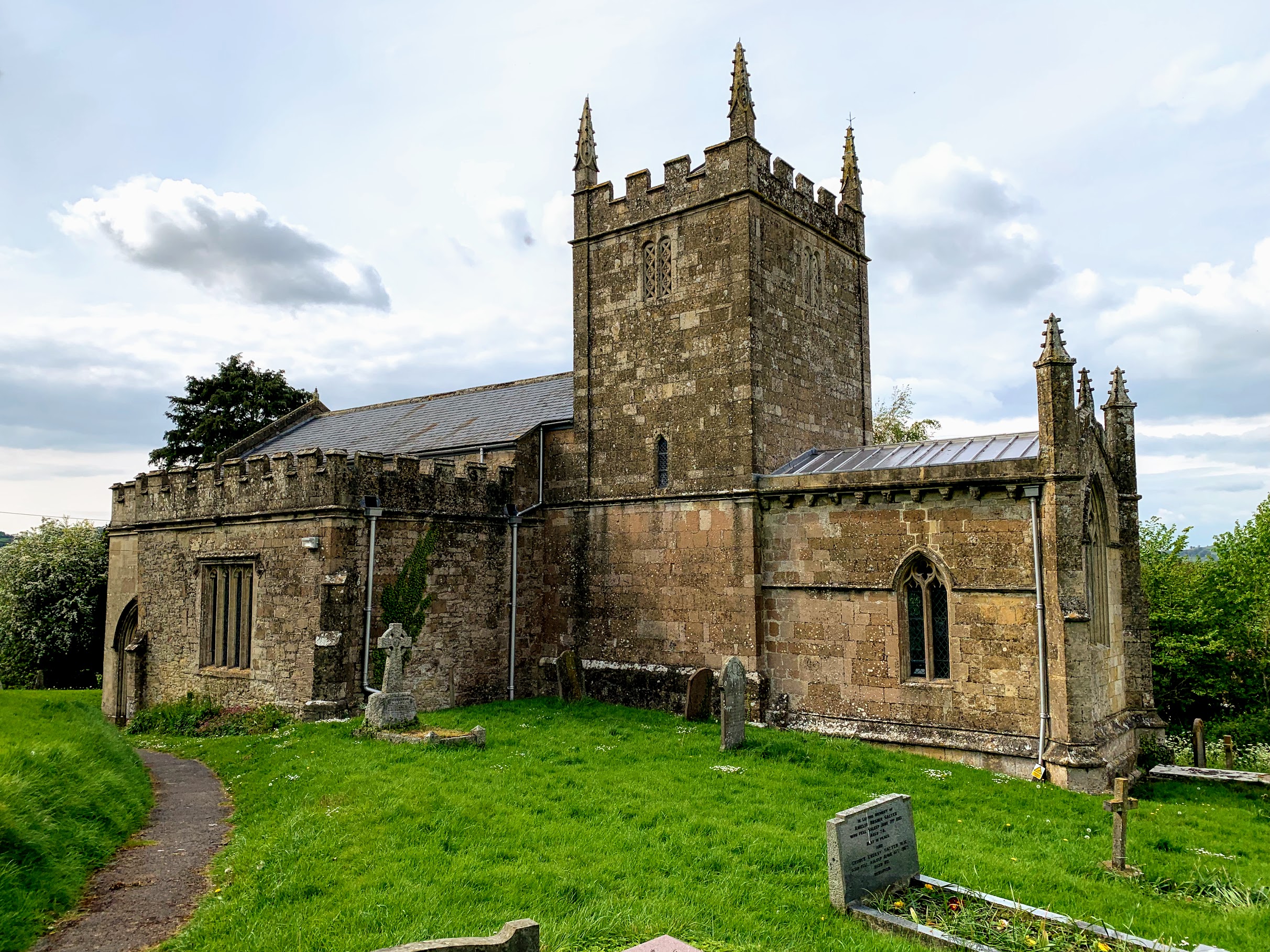
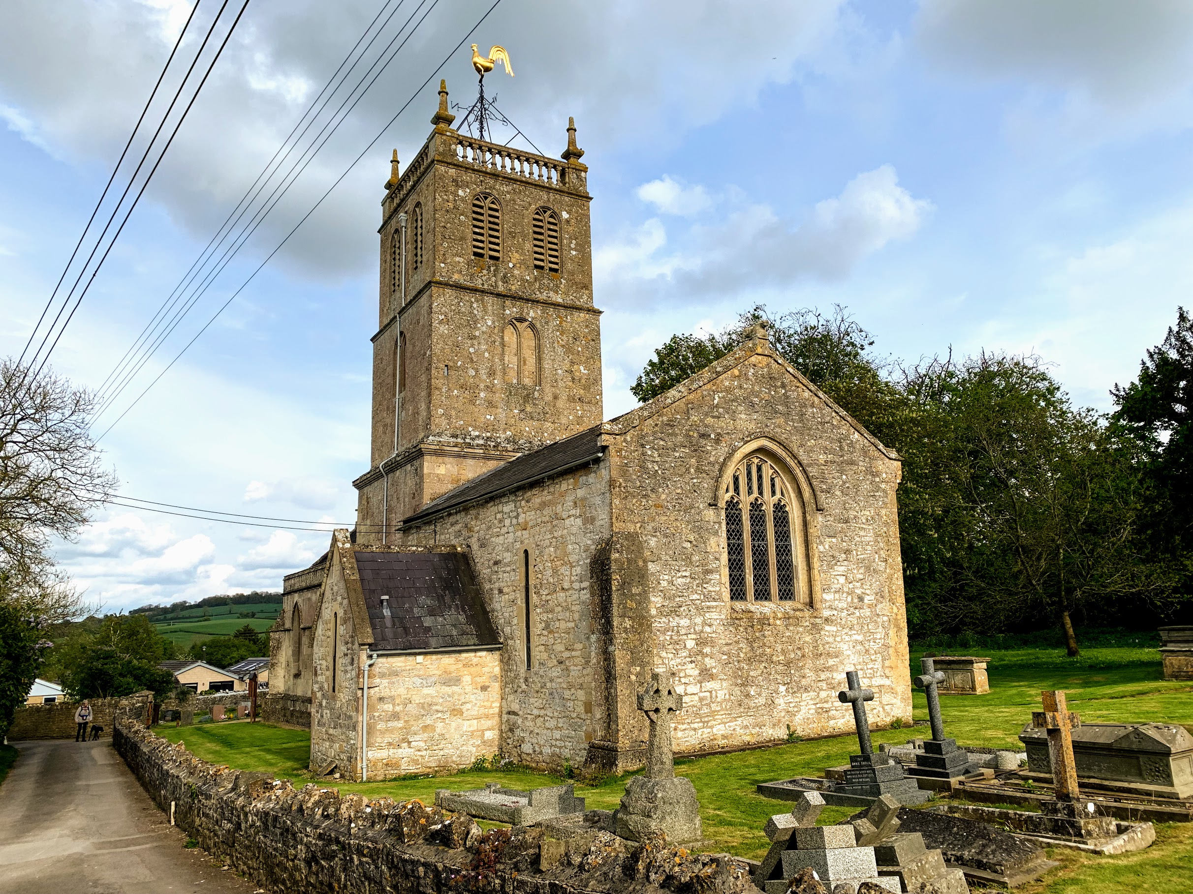
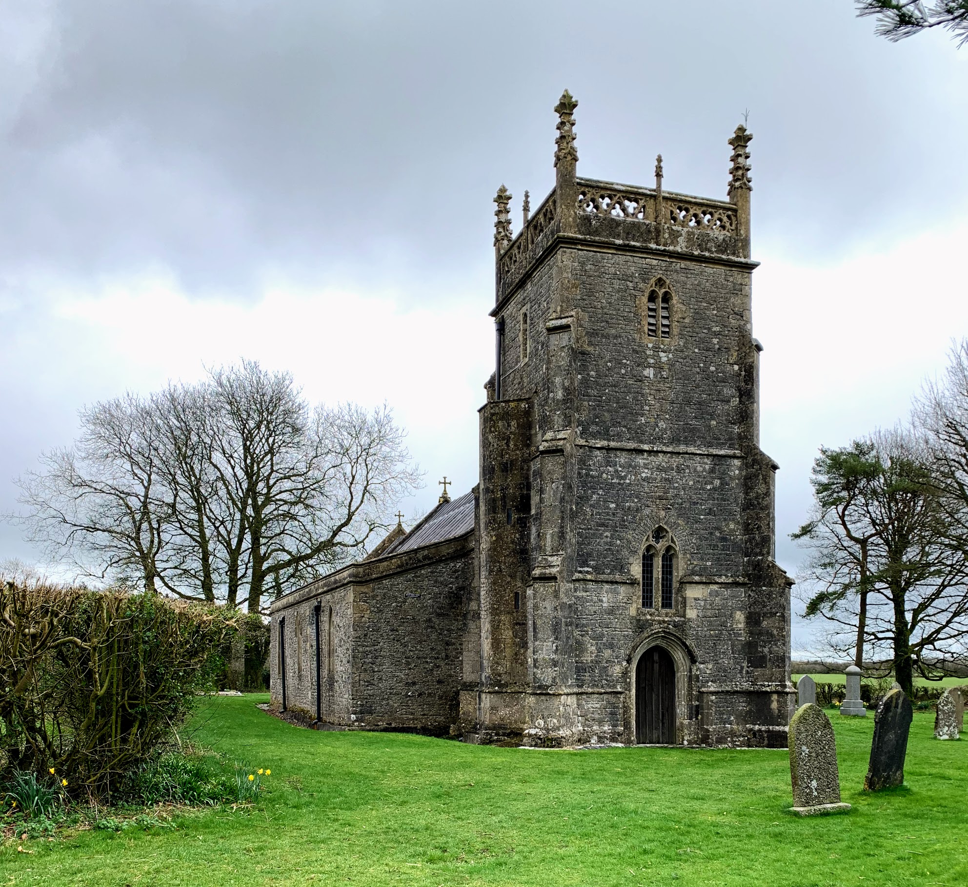
I had also intended to visit Englishcombe church, but it was not open (there was a notice giving numbers to call to gain access). Still, even from the outside, it is a very pleasing building. Pevsner has lots to say about it, but mostly about the inside. Apparently the Tower and part of the chancel are Norman, and indeed Wikipedia says it was built in the 12th Century by Robert de Gournay.
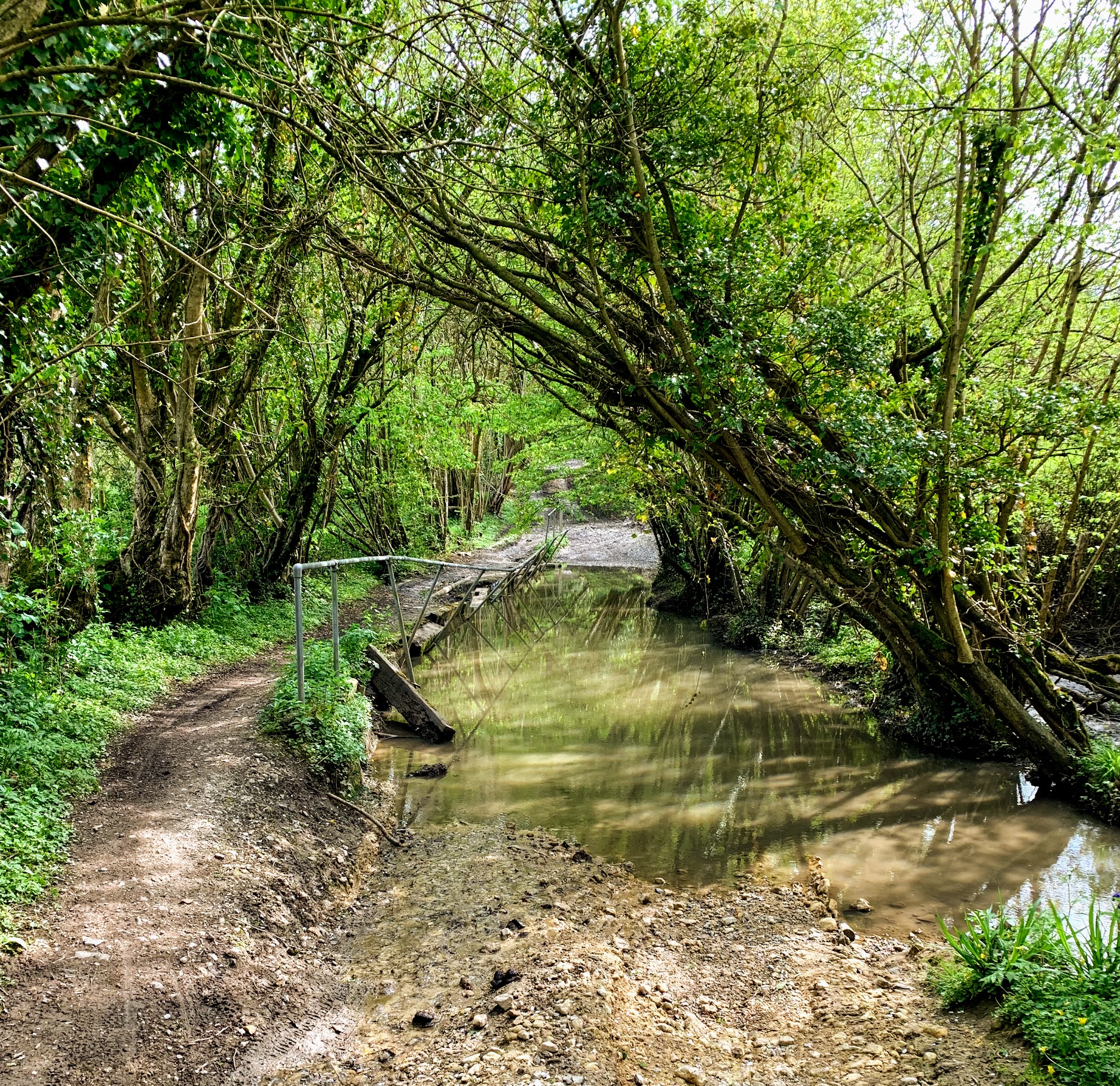
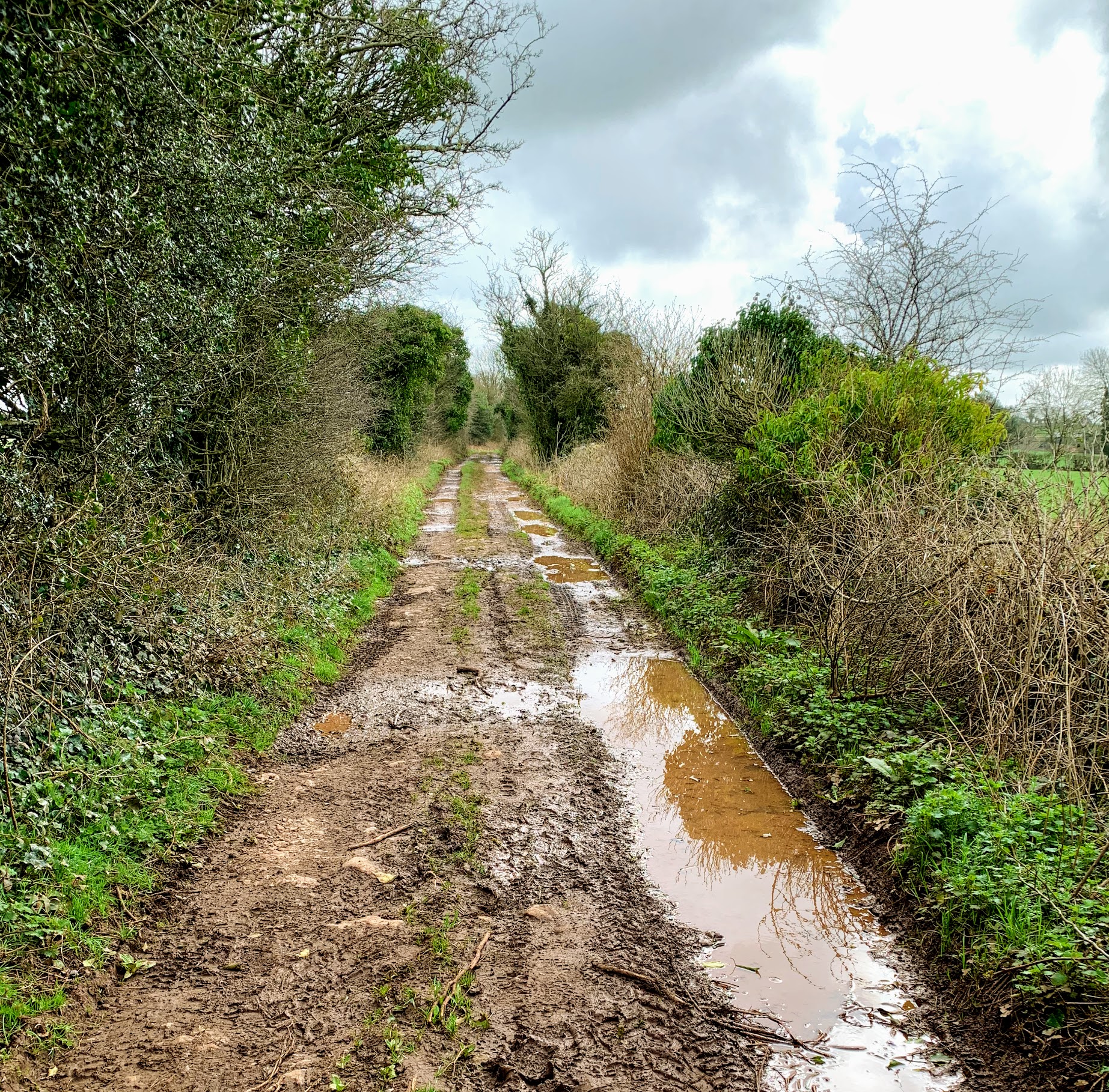
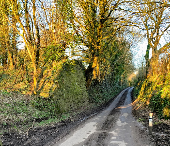
I then followed the byway to Inglesbatch (or English Batch as it is called on the early OS maps). This was easy, if slightly muddy, walking. It looked like it would be much more fun in a 4×4! If you follow me on Instagram, you will know that I am collecting pictures of named lanes, and I felt sure this would be one to add to the collection. But there is no trace of the name on recent or early OS maps, much to my disappointment.
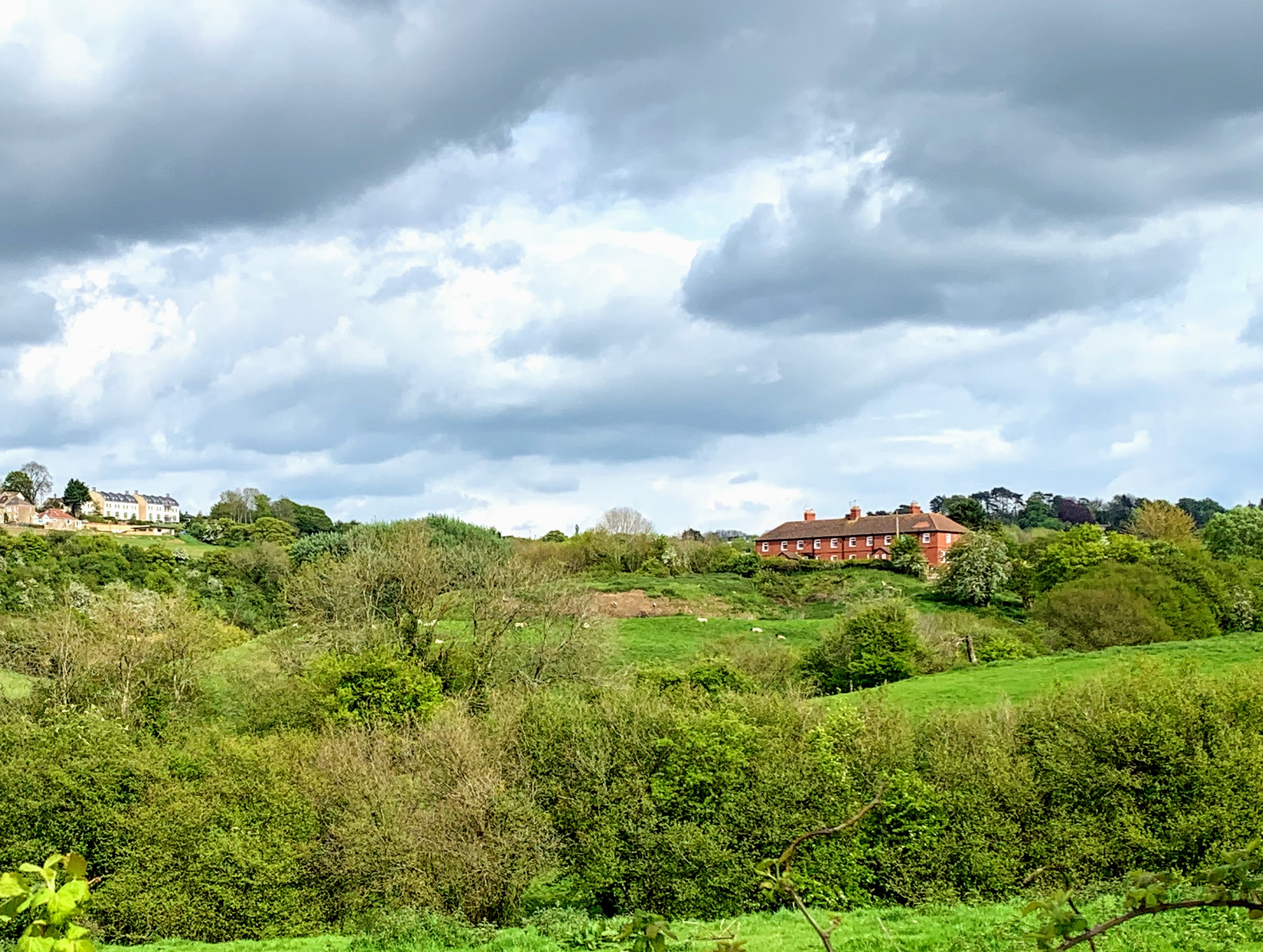
Inglesbatch itself is an incredibly pretty place. Another example of a place it is impossible to imagine affording to live in. I don’t imagine property comes up for sale very often in any case. There is absolutely nothing there, however, and it would take a stomp through the fields to get to the nearest pub.
Talking of which, my next stop was Priston, where I had intended to call in for a swift half. However, I had reckoned without the May Day Fair. The whole village was very busy and I didnt fancy my chances at the bar, so that treat will have to wait for another day. I didnt stop at the church either on this occasion, but hurried on to escape the crowds.
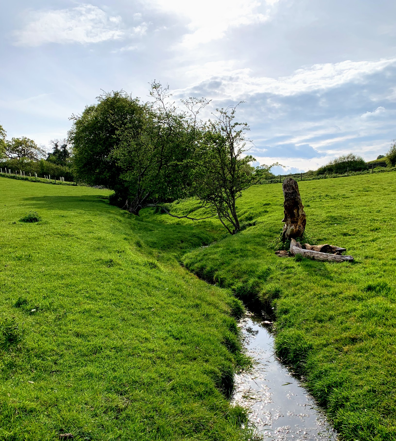
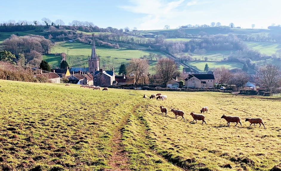
In fact, I swapped crowds of people for flocks of sheep and lambs. A good trade. The walk to Timsbury is through a valley of lush green fields, populated with the aforementioned ruminants. The slowly setting sun really made the spring-like colours pop and sheep are amusing when they nonchalantly but urgently get out of your way, so although this section was short on views I really enjoyed it.
The final part of the walk, from Timsbury to home, takes me through my usual stomping ground. It drops down from Timsbury via Mill Lane and heads along the old Somerset Coal Canal towards Paulton Basin. I’ll write a post about my local paths on another day, but today I was just relieved to be coming to the end. Overall, I had a wonderful few hours achieving an ambition I’ve long harboured.
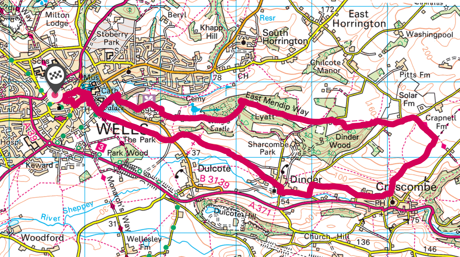
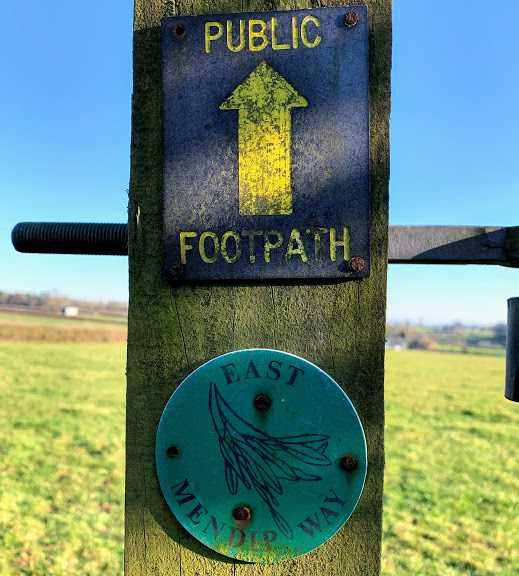
Another Mendip Way walk starting and ending in Wells, picking up where my previous walk ended and ticking off the beginning of East Mendip Way. I say that, but it’s not clear that the distinction between East and West Mendip Way will be around much longer. The Mendip Society are planning to have the whole route called simply “The Mendip Way” as part of their 50th anniversary. Makes sense to me!
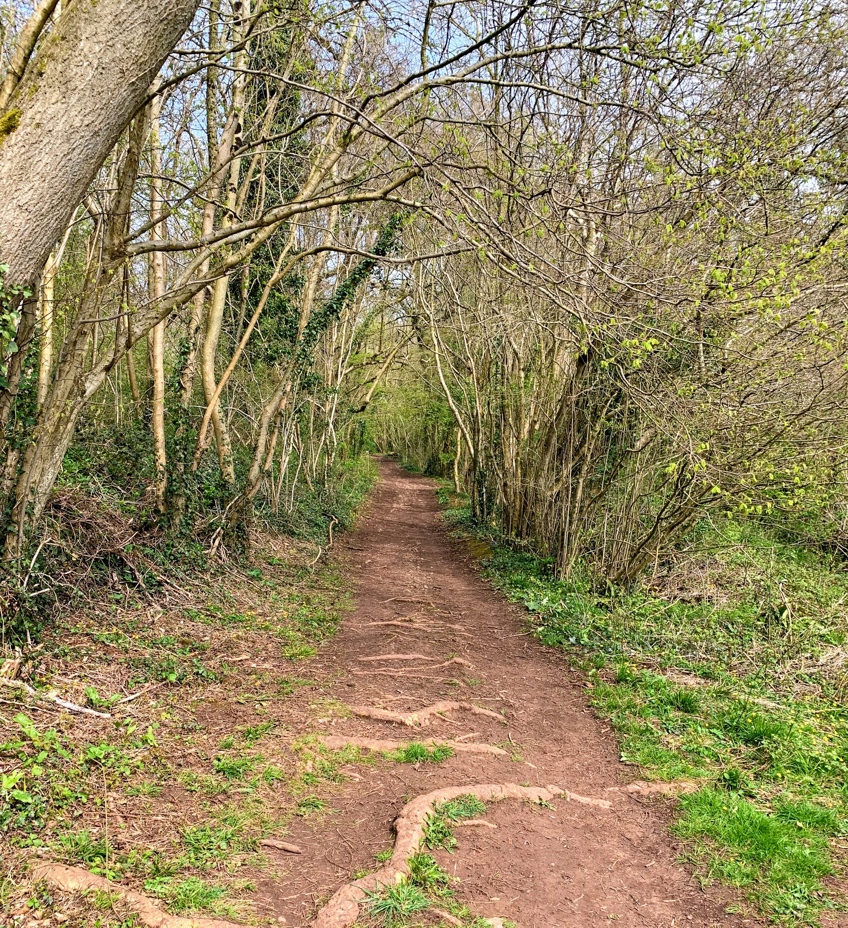
This walk starts at the Bishop’s Palace in Wells and heads up the hill through Tor Hill Woods, a national trust owned woodland. The path takes you pretty rapidly to the top of the hill and out into surprisingly wide open spaces.
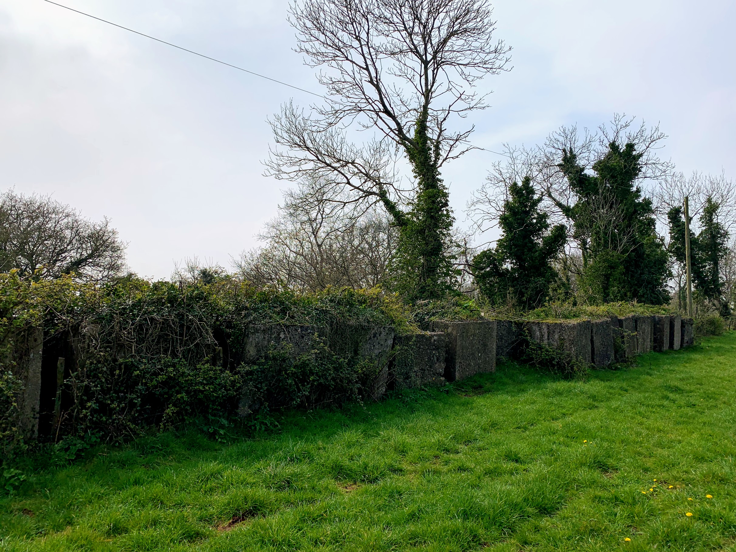
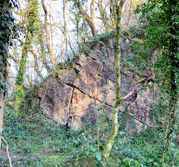
One thing that caught my eye was a boundary wall made of very large blocks of stone. I presume these came from the nearby (disused) Torhill Quarry. It certainly made for an unusual sight, although my photo above doesn’t really do it justice.
The path next passes through King’s Castle Woods. The woods are named after the iron age hill fort that resides withing them. More than just a fort, there seems to have been a larger settlement here. The remains of ancient field walls are fairly obvious as you pass out of the woods and onto the Lyatt. According to wikipedia, it has never been excavated and relatively little is known about it, although Lidar images show three enclosures along with the field system. There is speculation that it was a precursor to the city of Wells itself.
The path then passes on to the wonderfully named Furzy Sleight. According to The A-Z of Yeovil’s History the word sleight derives from the Old English slœget meaning a sheep pasture . Furzy presumably simply means covered with furze (or gorse), though it wasn’t so covered today.
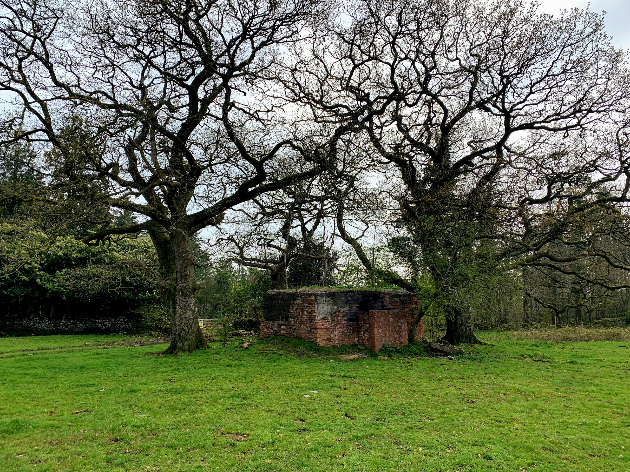
It wasn’t sheep that concerned me today, but cows. In the distance I could see a large herd, so decided to walk along the edge of the sleight rather than follow the path through the middle of them. Fortunately, this also brought me to the Furzy Sleight Pillbox, which I otherwise might have missed. This, of course, is evidence of more recent history. This pill-box was part of the “stop-line green”, one of 50 defensive lines built to defend against the expected German invasion in World War II. This line was part of the defenses of Bristol, and you can see where it ran on Google Maps.
I negotiated the cows without too much trouble, although there were a number of bulls amongst the herd. Fortunately, they had other things than me on their minds, although it did make my heart beat slightly faster! The Mendip Way then passes along Sleight Lane and across the fields to the point of West Lane where I joined it in Walk 1. I then walked down West Lane and into Croscombe. My original plan was to walk back up the hills on the other side and return to Wells via Dulcote Hill. However, I had a change of heart and decide to head back through the valley via Dinder.
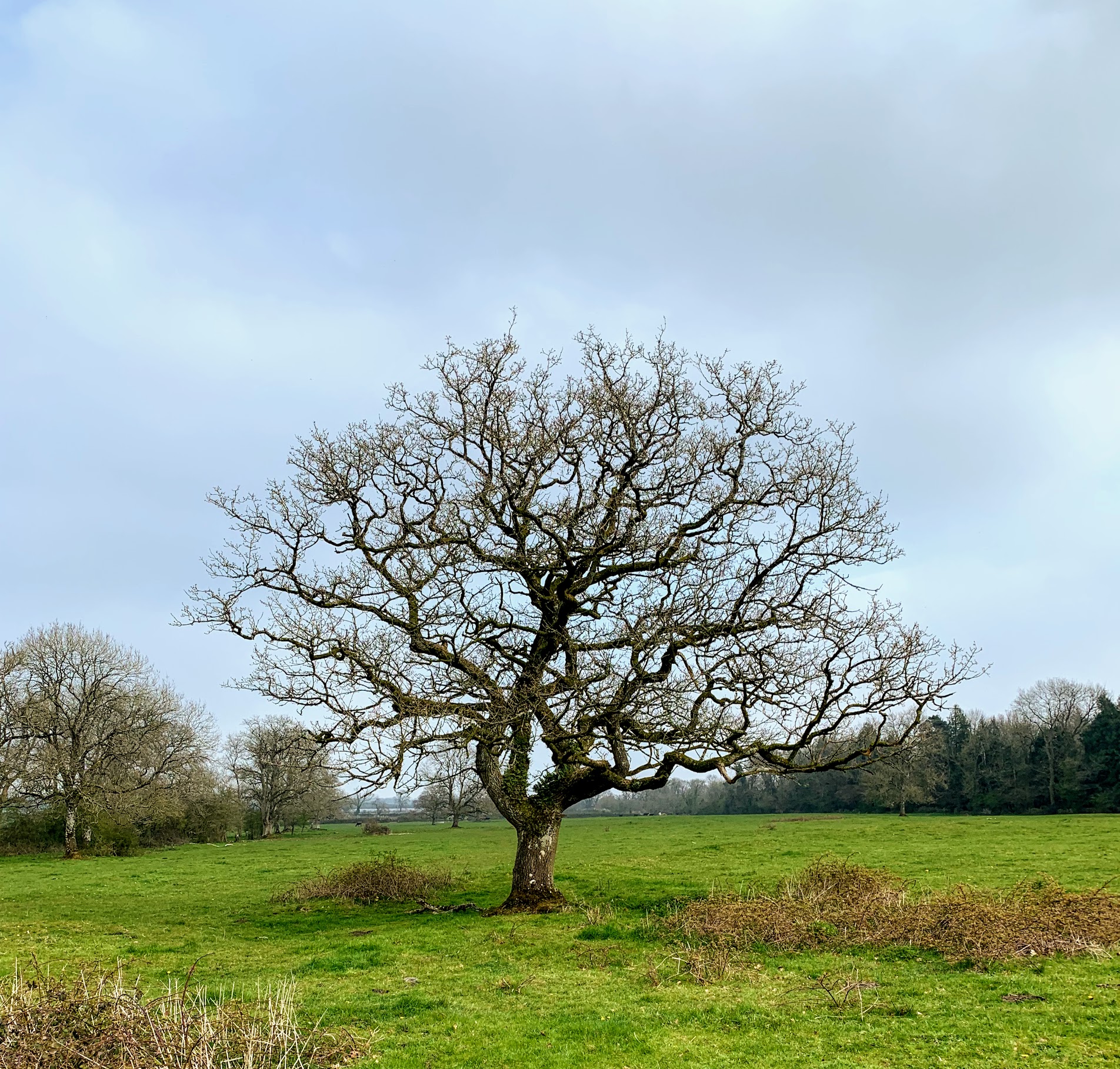
Dinder is an impossibly quaint village. I cannot imagine how anyone can afford to live there. There are many beautiful and interesting buildings, but the one that particularly caught my imagination was the vine covered house above. It looks to me like something from Annihilation – the house and tree are so symbiotically linked. I guess it will look very different in the summer.
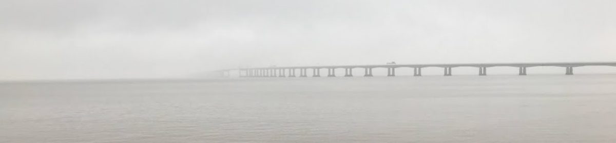
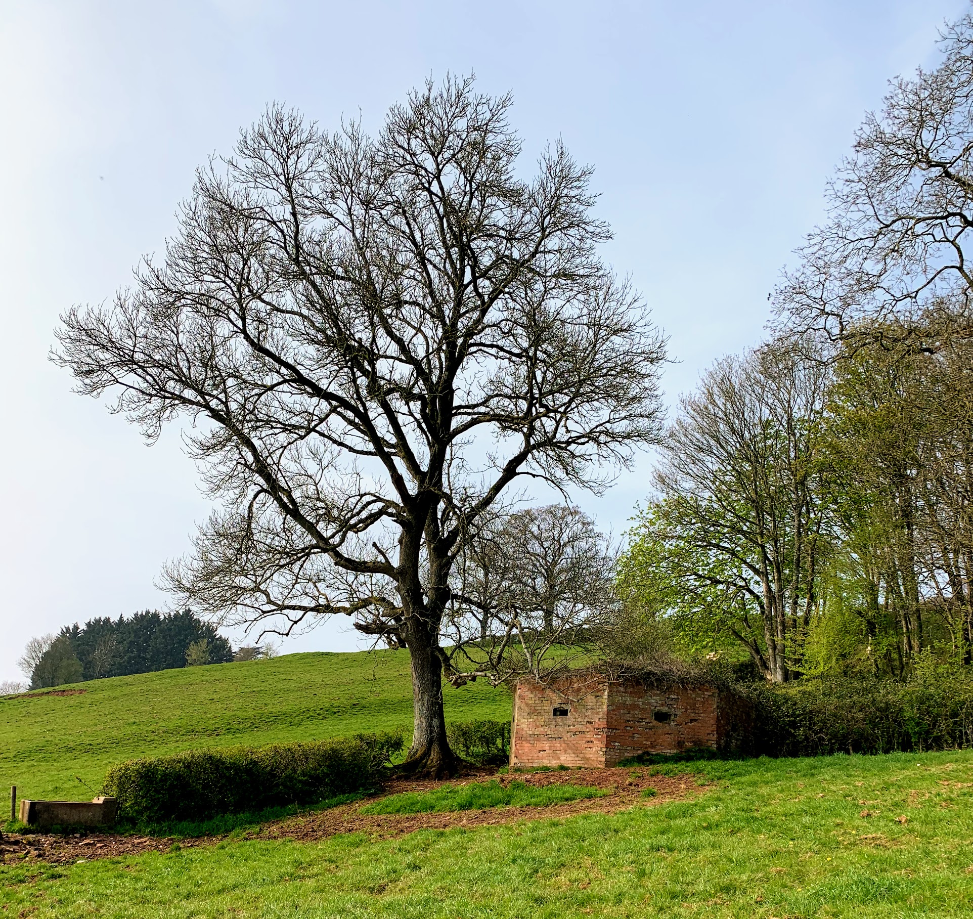
The walk back from Dinder to Wells is a pleasant stroll along easy paths through the fields. I made good time and was pleased with how much energy I still had left. I am definitely getting fitter. Along the way was another pill box, presumably part of the same defensive line as the previous one. The views out across the levels would probably be stunning on a less hazy day than today. Before long, I was back where I started and was heading back to the car for the drive home.
Today was another really enjoyable walk – and for a change, not too hilly either. So far, I have walked from Priddy to Shepton Mallet along the Mendip Way, and my planned walks have worked really well. Can’t wait for the next one!
I had a free morning today. I’d taken leave from work to finish an essay, but made much more progress over the weekend than I planned. So what better reward than a stroll along The Mendip Way. I chose to walk from Priddy, since for some reason I’ve never been and it felt like time to put that right.
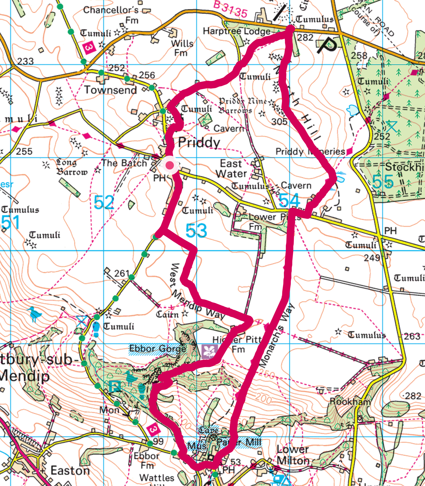
The plan was to start by following the West Mendip Way down through Ebbor Gorge to Wookey Hole. Next was a steep climb back up the hill along the Monarch’s Way followed by a much gentler climb up North Hill to take in the Priddy Nine Barrows. The weather was not great, a chilly wind and rain, but bearable.
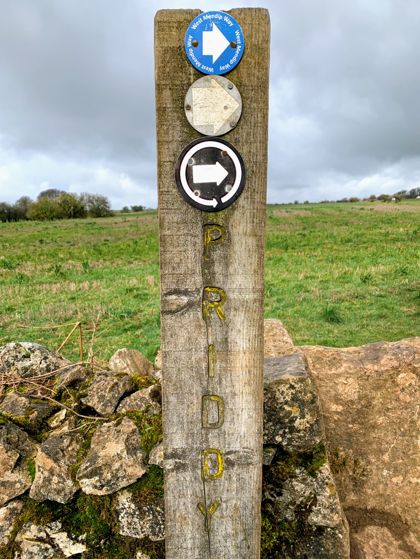
I parked up outside the Old New Inn (re-opening this year) and picked up the Mendip Way as it passed through Priddy. The start of this walk is well way marked, and is an easy stroll through the fields. The views across Somerset towards Glastonbury Tor are amazing and I really must come back in better conditions.
The Mendip Way runs for a short period along Dursdon Drove. It seems to be pretty well used by both walkers and vehicles, presumably because it provides access to Higher Pitts Farm. It is a pleasant walk inbetween the verdant green moss covered dry stone walls.
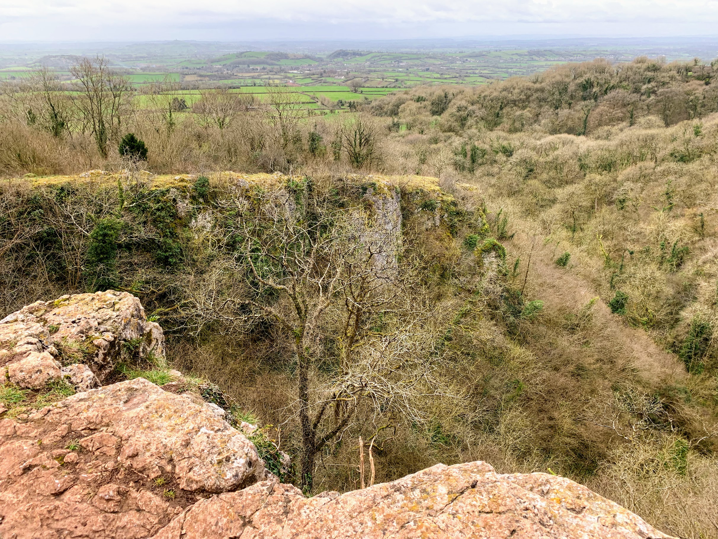
Everything gets a touch more dramatic as the path descends into Ebbor Woods. The rain and wind picked up at this point too. A helpful sign warned off a “Cliff ahead”. A warning we should all take seriously. And sure enough, there really was a big cliff. Stood near the edge in the wind and rain, the stone slightly slippery underfoot, I felt both awed and slightly quesy! It is a stunning place.
I guess it is not Mendip’s most dramatic gorge (Cheddar), but the surrounding woods make it a very different place. I realise I keep saying this in these blogs, but I will be back. It would be interesting to wander through at ground level. There followed a very steep and muddy descent, and the mud got much worse at the bottom. I was coated almost up to my knees, which rather changed my view about whether I was going to visit the pub at Priddy at the end!
There is not much to say about Wookey Hole. The Wookey Hole Caves
attraction was very quiet, perhaps not open. I passed their resident
Reindeer on the way up the hill, I guess they have a quiet life outside
of Christmas. I used to regularly frequent the Wookey Hole Inn when I
worked nearby (including an infamous afternoon session on a lethal beer
called Fruit Bat – far too easy to drink for it’s strength!) but it was
too early today and I was too muddy.
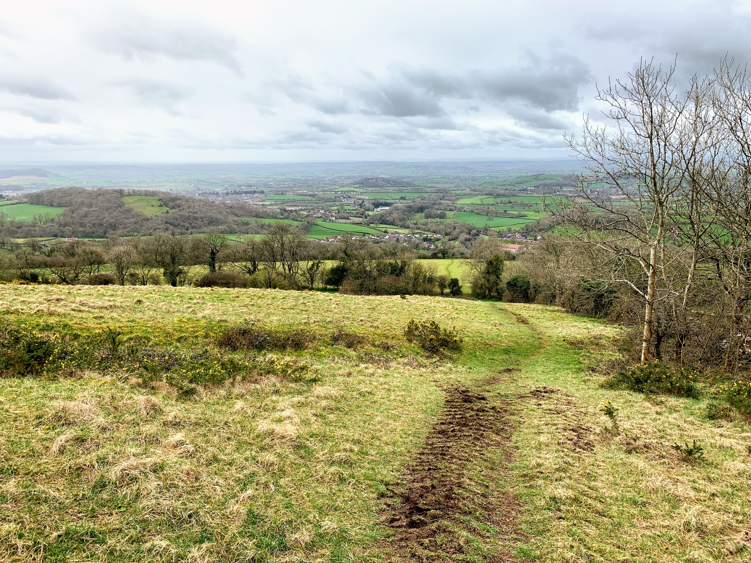
There is something to say about the walk back up the hill, however. I was right to be worried on the way down – it was very steep and very long. Steep hills expose my underlying lack of fitness and i could feel my heart beating very strongly in my chest. I genuinely wasn’t sure I would make it to the top. I was passed by a man running – training for an ultramarathon he told me. Fourth time he’d done the hill today. In a way that made me feel better. This hill is the sort of thing ultramarathon runners do to test themselves. When I *did* reach the top, I was elated. Genuinely. I guess that was the dopamine hit people talk about. The view, as you would expect, was special too.
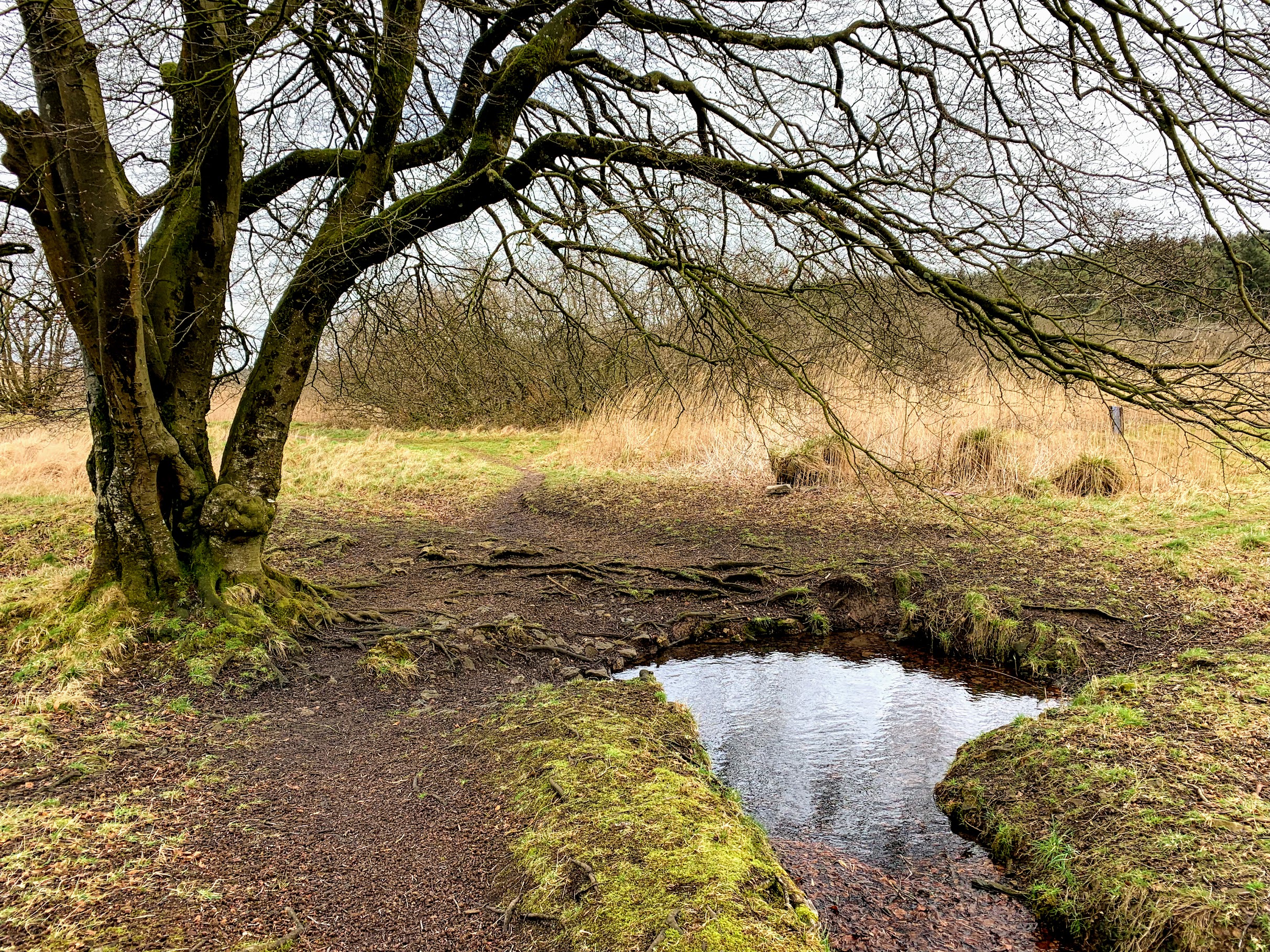
Even though I was only about half way, I felt I was on the homeward stretch after that. The walking from then on was easy and flat. The countryside around the Priddy Mineries reminds me, a bit anyway, of Dartmoor. The colours and wetness have that feel to them, and the intrerruption of old mine workings is reminiscent too. I even had to jump between divets of grass on a boggy section.
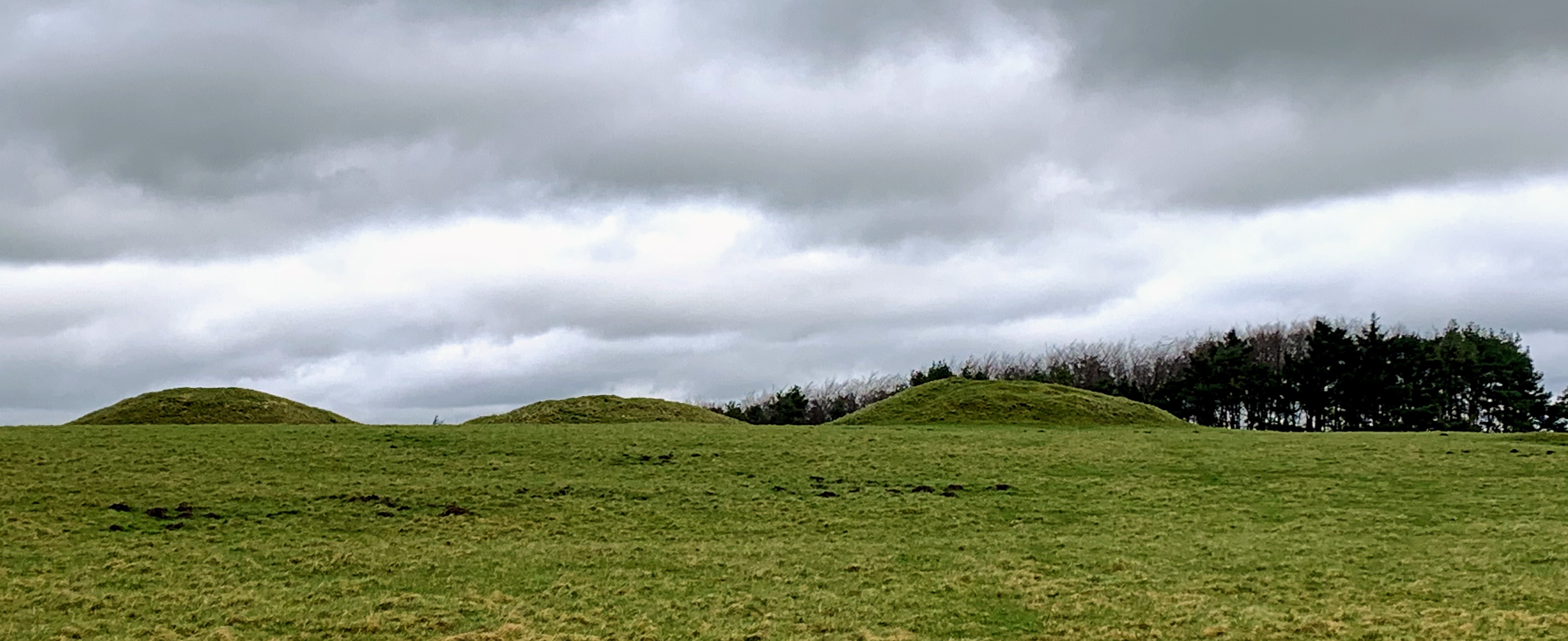
This feeling is further enhanced by the presence of Bronze Age monuments. Priddy Nine Barrows and the Ashton Hill Tumuli are a spectacular group of ancient burial mounds. I struggled to take a good picture. You really need to be there surrounded by them. They are not dramatic like Stanton Drew circle, but they are a stark reminder of our history and how little we really understand of the past. Definitely worth a visit. Priddy Circles, however, have lost whatever glory they once had. It is almost impossible to make anything out on the ground now. Presumably this bleak, barren, windy spot was once a significant place. Folklore has it, by the way, that one of the barrows contains a gold coffin.
It was now just a short walk along Nine Barrows Lane back to Priddy. I took a brief detour to visit the church, but it didn’t seem to be open. As I mentioned, I felt too muddy to visit the pub on this occasion. So there is at least one reason to go back! But there are plenty more. A very beautiful part of the world.
This year I have decided to explore The Mendips since they are right on my doorstep. I spend a fair bit of time driving through and over them, but haven’t spent any time exploring on foot for years. To this end, I have planned a series of 17 Circular walks of between 6 and 9 miles (ish) which cover the whole of The Mendip Way.
The Mendip Way runs almost 50 miles from Uphill, near Weston-super-Mare, to Frome. It is divided into the West and East Mendip Ways, with the join in Wells. It seems a pretty good way to see a good range of what The Mendips has to offer. There is lots more information here http://www.mendiphillsaonb.org.uk/walks/
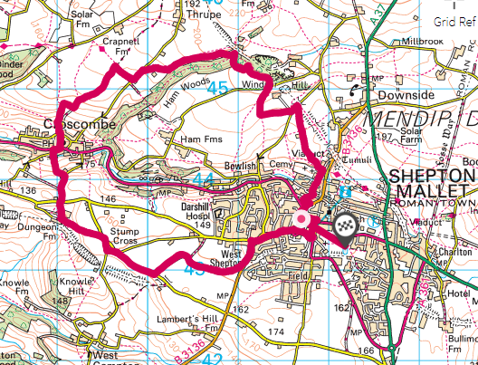
I’m not going to do my walks in order, and this first one is actually #12 in the series. It starts and ends in Shepton Mallet, which makes parking easy. The walk starts by heading west out of Shepton to pick up a footpath alongside the old Wells and Witham branch of the East Somerset Railway. There is a wealth of impressive old railway infrastructure in this part of the world (of more later) and here the remains of the road bridge and the route of the trackbed are obvious.
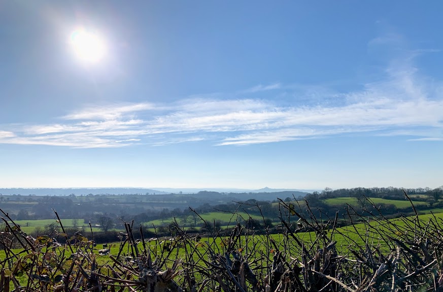
The route is then via the wonderfully named Dungeon Lane and Dungeon Farm. I’m nervous when a footpath leads through a farm, and today I could hear dogs barking in the distance. I needn’t have worried though, the farm seemed deserted and the route up the hill was clear. The view from the top was worth the effort of the climb – showing off this part of Somerset particularly well on a crisp February afternoon.
Next was a steep drop down to Croscombe. I avoided the temptation of the pub on this occasion (only because I had started a lot later in the day than intended) and headed straight up the hill on the other side. After the steep drop, I was anticipating a steep climb and I certainly got one. A reminder that I have a long way to go with my fitness! I also had to negotiate a field full of angry, aggressive, large horned sheep. Sheep usually move out of the way, so I was surprised when they all ran towards me, bleating loudly and stamping their hooves. I took a circuitous route which seemed to satisfy them.
From the top of the hill, it was a quick jaunt along West Lane before finally picking up the East Mendip Way. This part of the Mendip Way takes you across fields and farmland towards Ham Woods, and is very pleasant walking. It is well waymarked and I could put the map away and just follow the signs.
I was looking forward to Ham Woods, not least because of the tantalising word “Viaduct” on the map. I was not disappointed. The woods themselves were very atmospheric, full of winding, ancient looking, moss covered trees. And then the viaduct appeared, the sun came out and everything was simply stunning. The viaduct used to carry the Somerset & Dorset railway over this secluded valley – it probably has one of those SAD numbers that I had started to collect previously, but I couldn’t get close enough to see. There are other footpaths which lead close to the top. I will definitely be back.
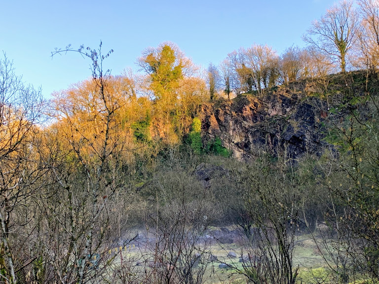
Ham Woods was not done with me yet, though. The path meanders through the woods, over some steep banks which required proper scrambling. This part of the Mendip Way is not “accessible”. The effort was really rewarded by Ham Wood Quarry. It suddenly got cold, there was crunchy frost underfoot and really eerie mist rising from the ground. I think I caught it at exactly the right moment. The dying sun peeking over the top of the cliffs and waking the ground. It was beautiful, and my photo does not do it any justice at all.
This was also my first encounter with the famous Mendip geology, as you can see in the top right of my photo of the quarry and the one directly above. I know very little about geology, so I’ve bought myself a couple of books on the area to educate myself. I believe this is Downside Stone, but I may be entirely wrong!
The walk from here, after ascending some steep steps to the top of the quarry, drops gently down across the fields and through the lanes back into Shepton Mallet. There are some more examples of disused railway infrastructure, although on this route you don’t get to see the other two even more impressive viaducts. All in all, this was a fantastic start to my Mendip adventures. I can thoroughly recommend this section of the Mendip Way.