Station to Station 2: Castle Cary to Bruton

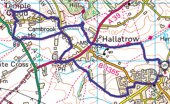
My second Station to Station walk was between Castle Cary and Bruton – a walk that took me about 2 hours on foot and about 7 minutes back on the train!

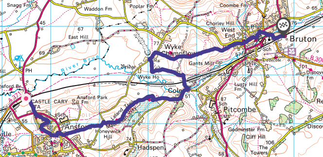
I really don’t know very much about the town of Castle Cary, despite driving past it every day on my commute. I didn’t learn much about it today since the station is outside the town and my route took me around the outskirts through the adjoining village of Ansford.

From this point on the walk follows the Leland trail, named after John Leland, librarian to King Henry VIII. This trail is a reconstruction of part of the route he took when visiting South Somerset between 1535 and 1543 cataloging the contents of monastic libraries and antiquities. Sounds like a great job to me.

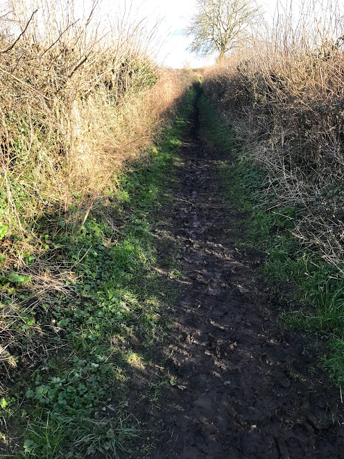
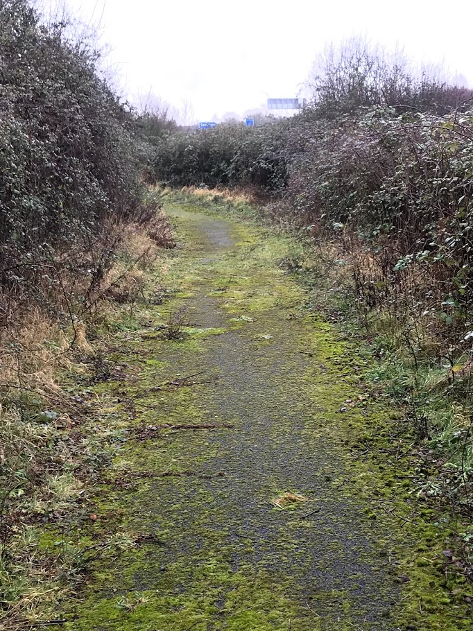
I deliberately chose this route to walk along a track that I’ve noticed almost every day and  wondered where it went – Solomon’s Lane. I do this a lot with footpaths. It transpires that until the road slightly further south was turnpiked in 1793, this was the main route to Bruton [1]. It doesn’t look much today. I wonder who Solomon was?

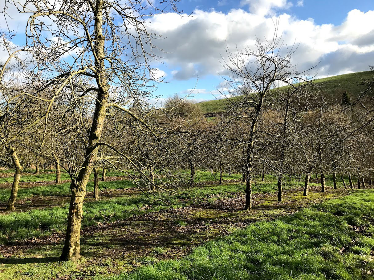
At the end of Solomon’s Lane, the path continues across some lovely Somerset countryside. Some slightly grumpy cows didn’t really want to move, so I walked off route a bit to give them some more room. The path continues through an orchard before arriving back at the road near to the village of Cole.

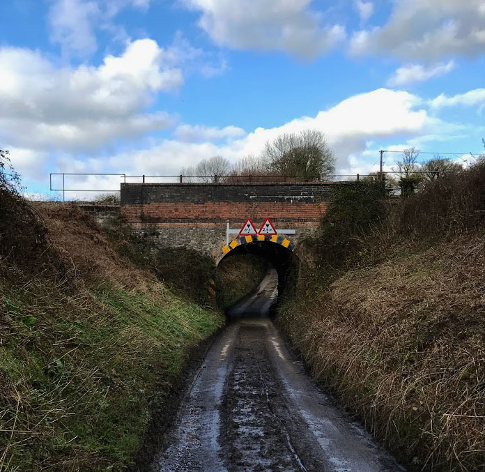
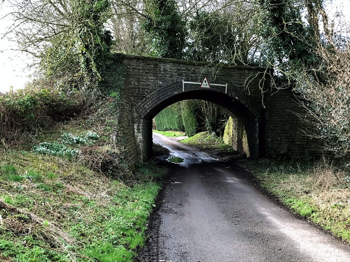
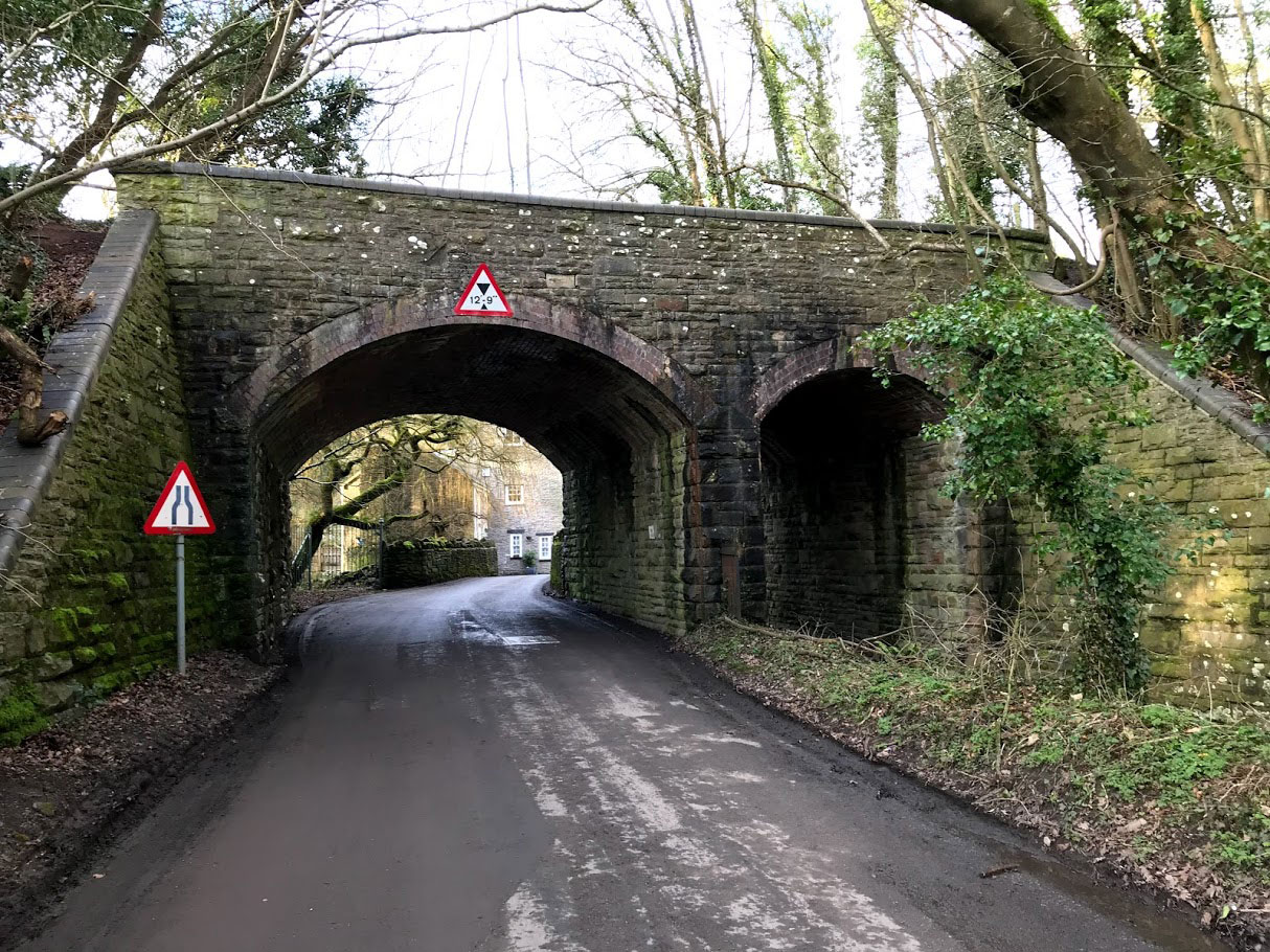
After passing under the current railway line, the road eventually passes under another bridge that once carried the Somerset and Dorset Joint Railway on its route from Evercreech to Cole. There isn’t that much left to see of it in this area, but it does seem to haunt all my walks. By the way, this bridge is labelled SAD-116, and another one that the road passes over SAD-115. I’m not sure whether these labels are original or not, but I can feel a box ticking exercise coming on.

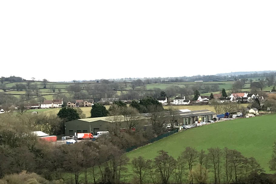
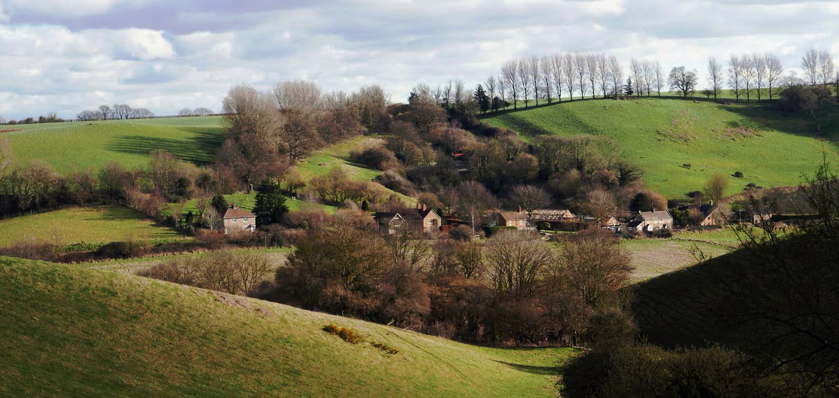
The last part of the walk is across the wide open fields of Wyke Farm, and finally down a well trodden lane into Bruton itself. Bruton is a very pretty town, full of history and tradition. It’s also, well, I can’t quite find the word – posh isn’t quite it, nor does hipster quite cover it. The fact that the Spar sells craft beer and Quinoa crisps maybe sums it up. I like it, by the way.

Frustratingly, I hadn’t left myself enough time to visit either of the pubs along the High Street, nor to pop into the museum. I fully intend to do this walk again, but using a more direct (hence quicker) route so that I can explore the town itself a bit more. This time I just headed straight for the station.

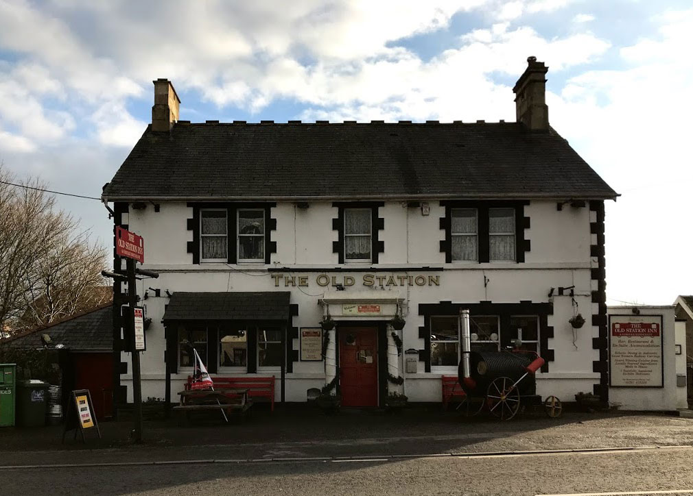
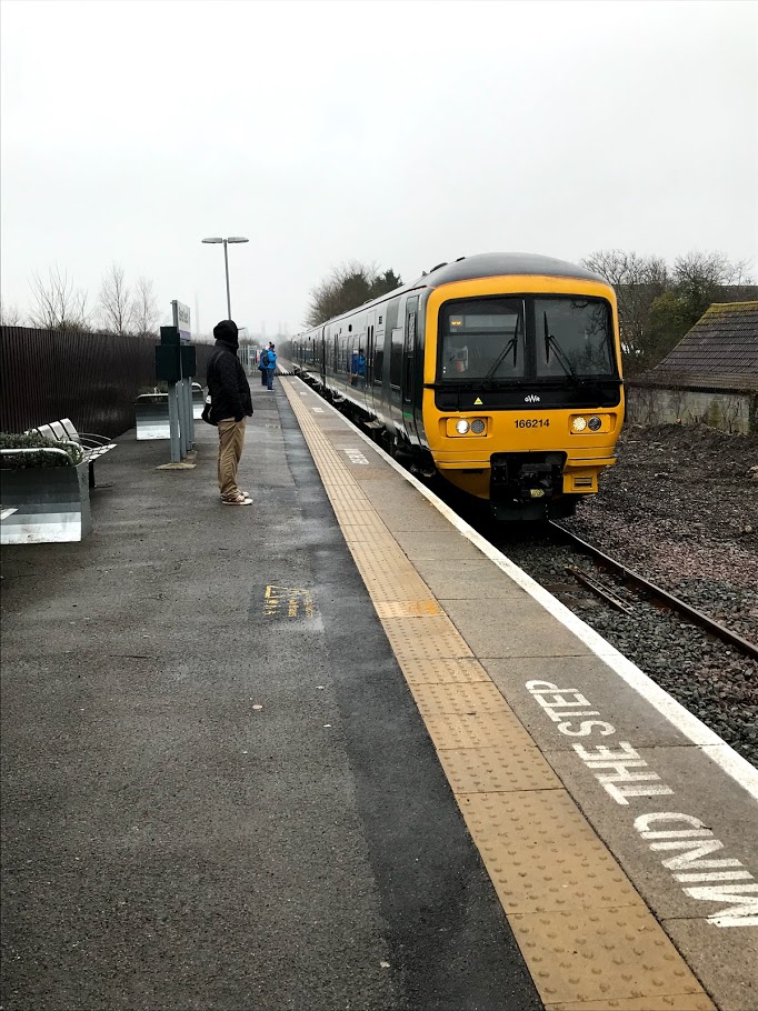
Bruton station is pretty quiet. (40660 entries and exits in 2016-17: 111 people a day). It was originally built as part of the Wilts, Somerset and Weymouth Railway, opening in 1856. These days it has a sporadic service through the day  – not regular. Hence the importance of catching my particular train, otherwise I had a 2 hour wait.

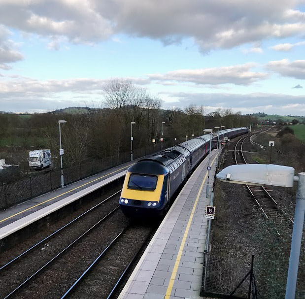
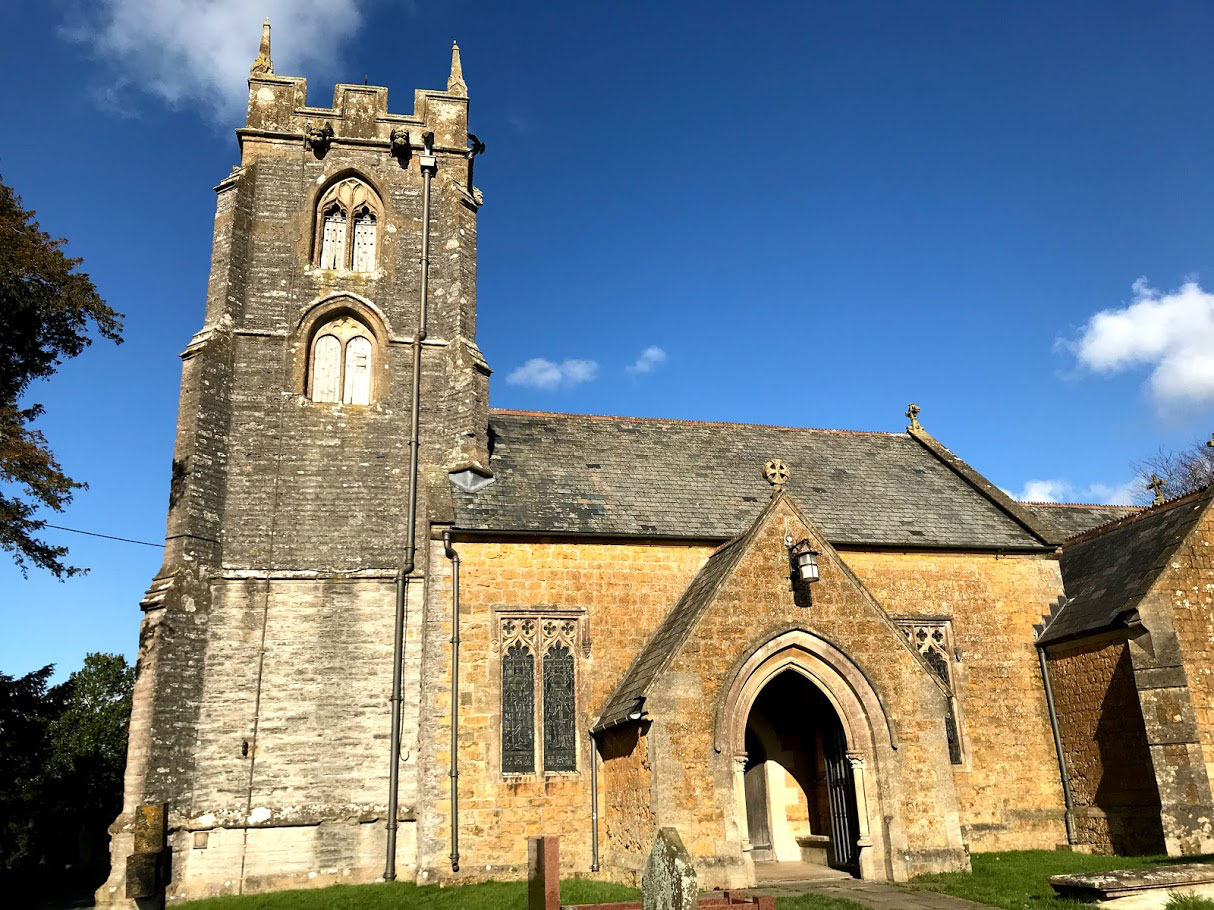
And so finally back to Castle Cary station, which sits astride the Taunton to Reading Line and the Bristol to Weymouth Line. It has a large (and quite cheap) car park to attract commuters, which is often quite full. However, the station really comes in to its own for the Glastonbury festival, when for a long weekend it is absolutely heaving – and well worth avoiding if you are not a festival goer.

Post walk note – I left my camera on a stile in the middle of this walk. I had to drive to a point as close to it as I could get and walk through the muddiest field I have ever seen in the vain hope that it might still be there. It wasn’t. However, a very kind woman had just picked it up for safe keeping and saw me striding with purpose and guessed it might be mine. And so I was reunited! I am incredibly grateful for kind strangers.

[1] ‘Ansford’, in A History of the County of Somerset: Volume 10, ed. Mary Siraut (Woodbridge, 2010), pp. 85-100. British History Online http://www.british-history.ac.uk/vch/som/vol10/pp85-100 [accessed 4 February 2018].

Camerton Branch – Hallatrow to Paulton

A wander around the section of the disused Camerton Branch of the Bristol and North Somerset Railway between Hallatrow and Paulton (26 Jan 2018).

The Camerton Branch is a long disused section of railway which ran between Hallatrow and Camerton to serve the collieries. Opened in 1882, it was later extended to Limpley Stoke where it connected with the Bath to Trowbridge line. It is probably most famous for providing the filming locations for the classic film “The Titfield Thunderbolt”.

It also happens to run close to where I live and so has become a regular haunt for me. Until 1915 (and for a brief period later) there was a passenger service on the line, but by all accounts this was never popular. How I wish it existed today!

This walk took me from Paulton along the line as far as Hallatrow and then back and forth across the line at every point that the footpath allows. At first the walk is directly along the old trackbed, although there is little else remaining of any old railway infrastructure. Note – not on this particular walk, but not far away there are very clear remains of Paulton Halt which are worth a visit.

I walked right to the point where the line to Camerton branched off from the main line. The footpath passes directly over this junction, but there is disappointingly little to see. The bridge over the Clutton to Hallatrow road remains as an impressive marker however.

As far as I can tell, there is nothing left of Hallatrow station itself. The site is now occupied by industrial units which at least make the old location obvious and are I think a good use of these sort of sites.

Also close by, and deliberately on route, is the Old Station Inn, which opened sometime between 1905 and 1929 by the evidence of the old OS Maps available online at the National Library of Scotland. This is a pub worth visiting – the beer is always good and there is an interesting collection of railway related miscellany and other pub clutter. You can also eat in a converted railway carriage attached to the back of the pub – though I think you need to book for this.

After a quick pint of Butcombe, I stomped back across the very muddy fields to Paulton.

Station to Station 1: Pilning to Severn Beach

This is the first in a series of walks between two different stations.

As walked route from Pilning Station to Severn Beach station.

On the 20th January I finally walked a route that I’ve been looking at on the map for ages, with the added bonus of ticking off an ambition to get to Pilning station. Pilning is not the easiest of stations to get to – it isn’t even listed in the timetable anymore. Instead there is a note against two Saturday trains from Cardiff to Taunton saying “Also calls Pilning”. The timetable also advises that to get there from Bristol requires a change at Severn Tunnel Junction. This reflects the removal of the footbridge and the resulting closure of the westbound platform. There are now no direct services from Bristol Temple Meads.

I caught the 07:23 GWR service from Bristol Temple Meads towards Cardiff Central. The guard commented that in 10 years in his job, he had never checked a ticket for Pilning before! However, he knew the route and told me where to change. Impressive.

Severn Tunnel Junction is a strange station – seeming to consist mostly of enormous (presumably accessible) footbridges. I guess in theory it serves the village of Rogiet, and other local commuter traffic. Perhaps it is busier later in the day or in the week but it was extremely quiet when I was there (253,918 entries and exits in 2016-17, so yes I guess it gets a bit busier). I will be back to explore another time – not least to make the walk to nearby Caldicot station.

Next up, the 08:26 to take me back through the Severn Tunnel to Pilning. This time the guard was confused by my ticket (because it was from Bristol) and didn’t understand what I was doing. She let it pass because it was “hardly any distance”. I had the timetable on hand to explain if I’d needed to.

On arrival at Pilning I was handed a Station Guide leaflet by one of the passengers getting on, who presumably has some part in the running of www.pilningstation.uk (we didn’t really have time to talk!) This contains a really interesting history of the station itself and the railways in the surrounding area. Definitely has me piqued my interest enough to come back and explore.

Pilning itself shows its neglect. It is run down, has no facilities and at present is surrounded by a building site – working on the electrification of the line I guess. While this is a shame, I can understand the lack of investment. It is not a well-used station (230 entries and exits in 16/17 – though this is a large increase from the 46 the year before), and it is in an awkward place – not really that close even to the village it serves. Nevertheless, I suppose it would get more use if there were more than 2 trains a week! The history of the station is interesting – see http://www.pilningstation.uk/tell-me-more/the-past for more details. I may write some of my own thoughts in a future post.

So at last the walk! This is a pretty straightforward route, starting off along the road towards Pilning village. I took the footpath through the allotments and cemetery of St. Peter’s Church. At this point I think you can still make out where the old train line from Pilning Low Level to New Passage Pier passed through, taking passengers to the ferry across the Severn.

I didn’t have a lot of time to stop and explore, but still I was as stubborn as ever about actually following the footpath, even when this probably isn’t strictly necessary. The footpath that cuts the corner across the fields as the B4064 curves around to the SW is a case in point – it was not easy to find, was obstructed and covered with brambles and when I did get to it, was across a very muddy field. Having done it once, in the future I will probably just follow the road around. However, the next section alongside the M49 is well worth walking along – the path is good and it feels odd walking right next to the motorway.  The footbridge over the motorway was a revelation too – it wobbled!

And so to Severn Beach. The “seaside” town that time forgot. A very unusual place indeed. Today I did not have time to seek out the disused amusements, or really to take in any of the atmosphere – the weather was rapidly worsening and I was just glad to get to the station and catch the train back to Temple Meads. The header photo for this blog gives an idea of the conditions.

The Severn Beach line is wonderful. It starts with the bleak industrial landscapes of Avonmouth and the Severn Estuary, then runs down the beautiful Avon Gorge and finishes up through the heart of Bristol itself. I am already planning many excursions along the line.


This was a terrific morning out – some interesting train journeys and an easy walk. The only thing missing was a pub or two. It was too early in the morning on this occasion, but I will be doing the walk in the opposite direction in the future, and there are two pubs to visit in Pilning – one of which is conveniently near the station. Perfect.

Link to route on OS Maps